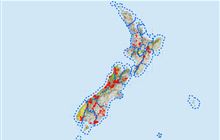
The Stack Conservation Area
Located in Cardrona Glenorchy Shotover hunting in the Otago region
|
Introduction
Animals present in The Stack Conservation Area are red deer and chamois, in low to moderate numbers.Species
- Chamois
- Deer - Red
Permit requirements
This hunting area is covered by an 'open area permit' – get it online or from a DOC office.
Dog access
About this hunting block
Animals present are red deer and chamois, in low to moderate numbers.
General information
The Stack Conservation Area covers much of the slopes of Roys Peak and Mt Alpha, which form the skyline to the west of Wanaka. The terrain is steep snow tussock with patches of alpine scrub. Faces on both the Motatapu Valley and Lake Wānaka side are steep and exposed; take care if traversing these. The terrain is prone to low cloud and is not recommend during the winter months or in poor weather conditions.
This block is balloted for the ROAR period during the months of March and April.
Access
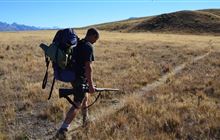
Hunting access to the Stack Conservation Area is either by helicopter or foot access. Foot access tracks cross private land and carriage of firearms is only permitted via the Fern Burn. For helicopter access, you must obtain a landing permit for one of three designated sites from the Mount Aspiring National Park Visitor Centre:
- North Stack Saddle E1286500, N5040360
- Lower Steels Spur E1286570, N5037090
- Southern Stack Ridge E1284010, N5033710
Within the block there are some farm roads and a poled ridgeline track from Mt Alpha over to Roys Peak.
Landholders
The hunting block borders farmland – hunters need to be familiar with the boundaries and stay within them.
Maps
NZTopo50 series: CB12
Dogs
Dogs are allowed in this block with a hunting permit. Dogs are not permitted via the Fern Burn access track.
Contacts
| Tititea/Mount Aspiring National Park Visitor Centre | |
|---|---|
| Phone | +64 3 443 7660 |
| wanakavc@doc.govt.nz | |
| Address | 1 Ballantyne Road Wanaka 9305 |
| Hours | See visitor centre hours |