Just offshore from New Plymouth is the stubble of an ancient but massive volcano much older than Taranaki Maunga. Formed 1.75 million years ago, soft rock has long since been eroded away leaving a group of low sea stacks and seven islands that provide a unique semi-sheltered environment along an otherwise exposed coastline.
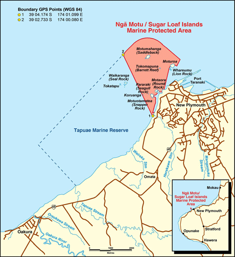
The Marine Protected Area comprises seabed, foreshore and water around Ngā Motu/Sugar Loaf Islands. It backs onto the northern boundary of the Tapuae Marine Reserve.
Marine environment
The subtidal marine habitats around the Ngā Motu/Sugar Loaf Islands include: spectacular canyons, caves, rock faces with crevices and overhangs, large pinnacles, boulder fields and extensive sand flats.
There are at least 89 species of fish, 33 species of encrusting sponges, 28 species of bryozoans and 9 nudibranchs.
The Ngā Motu/Sugar Loaf Islands are important for 19 species of seabirds, with approximately 10,000 seabirds nesting here. A breeding colony of New Zealand fur seals is there too.
Protection and recognition
The Sugar Loaf Islands Marine Protected Area was established in 1986 to control both fishing (under the Fisheries Act 1983) and non-fishing (under the Harbours Act 1950) activities. The formal protection of this area was supported by a traditional blessing with a tohunga (priest) placing a rahui over the area.
Concern about the areas degree of protection against oil prospecting and development led to the Sugar Loaf Islands Marine Protected Area Act 1991. The Act included a prohibition against mining.