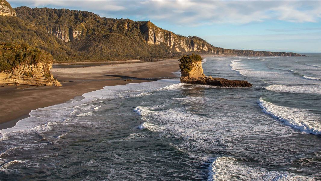
Image: Adris Apse | ©
Punakaiki Marine Reserve, Buller
Punakaiki Marine Reserve

Located in the West Coast region

Punakaiki Marine Reserve surrounds the pancake rocks and blowholes at Dolomite Point, one of the most distinctive landscapes of the West Coast. It covers much of the coastline at the edge of Paparoa National Park.

For tide, boundaries and other information you can download the MarineMate app.

The weather on the West Coast can quickly change. Always take good wet weather gear and warm clothes, and adequate food and water.

Always tell a responsible person where you are going, and when you expect to return. Pay attention to the weather and sea forecast, and be aware of large waves when walking on the beach or rocky shore.

Fishing: Enclosed by the reserve, there are two areas which allow for eeling, whitebaiting and recreational fishing at river mouths. Check the location carefully, as all marine life is protected within the reserve.

Riding of quad bikes and horses is allowed within the reserve, providing there is minimal disturbance to the site and riders comply with legal requirements.

Stones (no more than 256 mm in intermediate diameter), shells, driftwood, sand and gravel can be collected by hand recreationally, - but only as much as you can carry in one trip and with minimal disturbance to the site.

Pounamu can also be collected but only by members of Ngāi Tahu Whanui, or with the permission of Te Rūnanga o Ngāi Tahu.

The gold mining operation already existing on 7 September 2014 can continue to operate as long as it remains of the same scale and extent and complies with all relevant legal requirements.

Farmers with land adjoining the reserve can drive cattle or sheep using dogs, and operate a motor vehicle, on the foreshore provided there is minimal disturbance to the reserve site and compliance with all legal requirements.-Note: This applies only to the part of the marine reserve that is south of a line extending west from the southern boundary of the coastal portion of the Punakaiki Scenic Reserve and through a point at 42°14.74′S and 171°32.35′E.

For the purpose of opening the outlet of Hibernia Creek, the owner/occupier of the land adjoining the marine reserve may use non-motorised hand-held tools; and front end loaders, excavators, etc.  

Punakaiki Marine Reserve covers more than 35 square km from Perpendicular Point to near Maher Swamp, and out to two nautical miles from shore. Paparoa National Park and the marine reserve combined, protect heavily forested land and water catchments from the mountains out to sea.

The reserve surrounds Dolomite Point’s pancake rocks and blowholes, one of the most distinctive landscapes of the West Coast. The pancake rocks are 30 million year old limestone formations – the shells of ancient marine animals overlaid with soft mud and clay, raised by earthquakes and etched out by the sea.

The sea is still working on this natural sculpture, rasping through spectacular blowholes in the rocks.

Visitors to the rest of Punakaiki Marine Reserve will find a representative slice of wild West Coast life – rocky and gravel shores giving way to forests of bull kelp and other seaweeds, and vigorous waves rolling in from big, windswept seas.

On stormy days, plankton (microscopic floating plants and animals) are whipped up by the frenzied sea, washing up as a frothy band of sea foam that is sometimes a metre or more deep on the beach. 

Westland petrels breed in the hills above Barrytown Flats, and are often seen in the reserve. Albatrosses, petrels, terns and gannets also pass through. Blue penguins and Hector’s dolphins can be seen within the reserve.

Offshore, beyond rocky reefs, the seabed is mostly a rippled surface of sand and mud that provides habitat for burrowing surf clams and worms, as well as fish like stargazers, gurnard and sharks. The driftwood-strewn cobble ridge beaches of the Barrytown flats are a feature of the central and northern West Coast.

Several rivers and creeks meet the sea at Punakaiki Marine Reserve, creating a variety of mouth formations that link to coastal streams and wetlands.