Toaroha/Zit Saddle/Kokatahi/Lathrop Saddle/Styx River Route
Located in Kokatahi River - Whitcombe River area in the West Coast region
|
Introduction
This route traverses alpine ridges and crosses two alpine saddles. It demands experience and good route finding skills in other than fine weather conditions.Dog access
This route is suitable for fit, well equipped and experienced backcountry trampers only. The best seasons to go are summer and autumn due to snow/ice on alpine sections during winter. Times are a general guide only.
Note: True Left and true right refer to the side of the valley or river when looking downstream.
Roadend to Cedar Flat Hut
Time: 3 - 4 hr
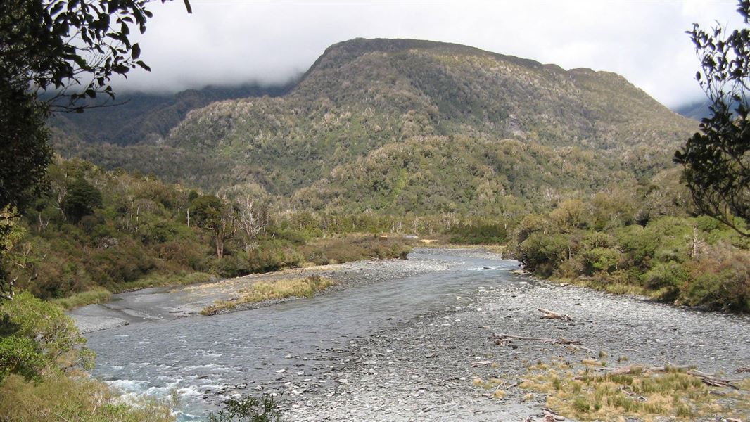
From the car park follow the rough farm road down to river level, then pick up the orange triangular markers and follow these across the open flats to the bush line and the start of the track. The track initially follows an old logging tramline over a low terrace before exiting onto the river bed and following the true right bank. On this river bed section watch out for boulders tumbling from the steep gravel faces above. (If the river is running high, a flood track travels above the gravel faces; there is a sign posted turn off for this before the riverbed is reached).
After about 1 km of river bed travel, the benched track recommences 200 m upstream from an unnamed creek then climbs steadily above the Toaroha Canyon. It descends gradually to the lower end of Cedar Flat where a short rock hop and track leads to the Cedar Flat Bridge which is crossed to the Cedar Flat Huts.
There are various small hot springs a short distance up Wren Creek, which enters the Toaroha River on the true right opposite and upstream from the huts. (Cross the lower swingbridge and follow the sign-posted track to reach these). The springs seem to alternate in hottest temperature and best output. The newer of the huts at Cedar Flat contains 12 bunks and is heated by a woodstove.
Cedar Flat to Adventure Ridge Bivouac
Time: 3 - 4 hr
From Cedar Flat Hut follow the short section of track to the upstream swing bridge and cross to the true right. The track to Adventure Ridge Bivouac begins between Median and Esma Creeks and is a typical West Coast ridge track, it climbs steeply to a bush terrace then up adventure ridge itself to alpine scrub and tussock. Adventure Biv is located at the top end of a tussock clearing at an elevation of 1,020 m.
Adventure Ridge Bivouac to Top Kokatahi Hut
Time: 3 - 4 hr
From the bivouac follow the track through the tussock and alpine scrub. It climbs and sidles before dropping into, crossing and climbing out of, a deeply cut tributary of Zit Creek. Once in the open tussock the route is marked with poles (orange triangles mounted on thin fibreglass stakes) and climbs a spur (steeply in places) directly to the ridgeline of the Toaroha Range about 500 m north of Zit Saddle.
The poles guide you directly over the ridgeline down to and across a tussock terrace before dropping steeply down a rocky gut to an un-named tributary of the Kokatahi River. The creek is followed until about 50 m above the confluence with the Kokatahi. Exit on the true right here and head upriver for 50 m to Kokatahi Hut.
In misty conditions good route finding skills are required as the marker poles are difficult to see from one to the next.
Top Kokatahi Hut to Crawford Junction Hut
Time: 4 - 5 hr
Note: This is a fine weather route only – even at normal flow it has a number of swift river crossings.
From the hut travel to the confluence of the Kokatahi River and the unnamed stream from Zit Saddle. Cross the Kokatahi to pick up the cut track on the true right. The route alternates between sections of cut track and riverbed travel, crossing the Kokatahi three times before ending up on the true right above the Top Kokatahi swing bridge.
After crossing the swing bridge the track remains on the true left until a cableway is reached. Cross this cableway to the true right and continue downstream along the river edge for 200-300 m then pick up the track through the forest and follow this to Crawford Junction Hut which is sited on a low terrace overlooking the Crawford/Kokatahi confluence.
See guidance on using the cableway under 'Know before you go'.
Crawford Junction Hut to Top Crawford Hut
Time: 3 hr 30 min – 4 hr
From the hut follow the track off the terrace and down to the bed of Crawford Creek. Head upstream, boulder hopping past the swing bridge, and pick up the track to Farquharson Creek. Cross Farquharson Creek and rejoin the track on the far bank. Following the track towards and then up alongside Crawford Creek before climbing out of the creek and sidling around the hillside.
The track continues to sidle around the hillside until it drops down into Crawford Creek about 750 – 800 m below Top Crawford Hut. Remain on the true left of the creek all the way to the hut, which is located on a low tussock terrace a few hundred metres upstream on the true left branch of the Crawford Stream.
Note: Farquharson Creek can be difficult to cross if it is running higher than normal. A good crossing place is upstream at the mouth of the gorge.
Top Crawford Hut to Browning Bivouac
Time: 3 hr 30 min – 4 hr 30 min
From the hut, travel downstream until just before the junction of the two branches of Crawford Creek. Cross to the true right bank and pick up the large orange triangle and then follow orange markers through a tussock/scrub covered gut. After a few hundred metres the track begins to climb steeply through scrub covered bluffs until it tops out on a small terrace. From here a few poles mark the route which climbs and sidles up and across steep scree slopes in a north/north-easterly direction to Lathrop Saddle.
In the winter and spring these slopes are snow covered and often icy. Ice axes and crampons are essential tools at these times. Marker poles from the northern end of Lathrop Saddle lead the way down a steep spur to Browning Bivouac. It is easy to miss these poles in misty conditions.
Browning Bivouac to Grassy Flats Hut
Time: 1 hr 30 min – 2 hr
From Browning Bivouac the track drops steeply down the hillside and into an unnamed creek. Once in this creek, travel varies between boulder hopping and sections of track. This continues until the track veers away from the creek on the true left before continuing downhill and eventually joining up with the Styx Valley track. From this junction it is about a 5-minute walk upstream to Grassy Flats Hut.
Grassy Flats Hut to Mid-Styx Hut
Time: 3 hr 30 min – 5 hr
From the hut head downstream and re-cross Styx River. The track begins on the true right just below the prominent toetoe flat (toetoe is a tall native grass that looks similar to pampas grass).
Head down stream on the true right for around an hour. At sign indicates the route down to the river and to Mid Styx. The river must be crossed to pick up the route on the true left, however due to the constantly changing nature of the river, the crossing may be 100 – 200 m up or downstream of the sign.
Dependent on the river crossing point it may be necessary to cross a large side creek in order to pick up the route to Mid Styx Hut.
The route climbs steeply to a terrace and after around 30 minutes you’ll arrive at the Hut.
Mid-Styx Hut To Lake Kaniere Road
Time: 2 hr 30 mins to 3 hours
From mid-Styx the route continues along the terrace for about 30 minutes before dropping steeping into Tyndall Creek. This descent is exposed in places. Once in Tyndall Creek cross to the true left and travel for just over a kilometre to the Styx River.
The route then travels downstream on the true left of the Styx River. The Styx is crossed again to and an old farm track leads to the carpark at the Lake Kaniere Road.
Turn off the Kokatahi/Lake Kaniere circuit road at the signpost 'Access to Toaroha Valley', cross the bridge over the Kokatahi River and follow the road as far as your vehicle will allow. Farm gates should be left as they are found.
Permission to cross the farmland must be obtained from the leaseholder, Terry Sheridan, telephone +64 3 755 7967.
What to expect
This route traverses alpine ridges and crosses two alpine saddles. It demands experience and good route finding skills.
Throughout winter and into late spring the alpine areas will have a cover of snow, especially the southern side of Lathrop Saddle. If travelling the route during this part of the year it is recommended that each member of your party carries an ice axe and crampons and is familiar with their use.
Styx Valley Track
Styx Valley Track is very rough with numerous slips to be negotiated. These slips are moving after each rain event and can be difficult to cross by inexperienced people.
The Styx River has cut into a vertical gravel cliff 20 minutes from the Styx car park. To continue up the valley be prepared to cross the river at normal flow below and above this slip. Parties or individuals that are not confident with river crossing should travel through via the Arahura valley.
The alternative via the Arahura Track has a major slip south of Snowball Creek. Caution is advised when crossing this slip.
Other hazards
- Flooded rivers and side streams
- Ice and snow during winter
- Storm damage to routes and re-growth of vegetation that will slow progress – allowances must be made for possible delays through bad weather, or track damage.
This information is an indication of conditions only.
Topomap: NZTopo50 BV19 Lake Kaniere.
Using the cableway
A cableway is used to cross rivers on this trip. Take time to read the on-site instructions and familiarise yourself with the operation of the cableway before crossing
Use of this cableway carries risks, so follow the operating instructions carefully.
It is recommended that you do not use this cableway unless part of a larger party or carrying a personal locator beacon (PLB).
Never place your hands on main cable, and keep hands, clothing and long hair clear of all wheels.
In the event of an emergency where the carriage becomes stuck, remain where you are and activate your PLB or have your party seek help.
Stay safe when crossing rivers
If you plan to cross unbridged rivers, know how to cross safely and be prepared for if you cannot cross.
Do not cross if the river is flooded, you cannot find safe entry and exit points or are unsure it’s safe. Turn back or wait for the river to drop. If in doubt, stay out.
Stay safe in the outdoors
- Choose the right trip for you. Learn about the route and make sure you have the skills for it.
- Understand the weather. Check weather forecasts.
- Pack warm clothes and extra food. Check gear lists.
- Share your plans and take ways to get help. Share directly or use the Outdoor Intentions form or Plan My Walk. Take a distress beacon.
- Take care of yourself and each other.
Contacts
Paparoa National Park Visitor Centre | |
---|---|
Phone | +64 3 731 1895 |
paparoavc@doc.govt.nz | |
Address | 4294 Coast Road Punakaiki RD 1 Runanga 7873 |
Hours | Visitor centre hours and services |