Image: Jose Watson | DOC
Hokitika  Gorge Walk.
Hokitika Gorge walks

Located in Hokitika Gorge Scenic Reserve in the West Coast region

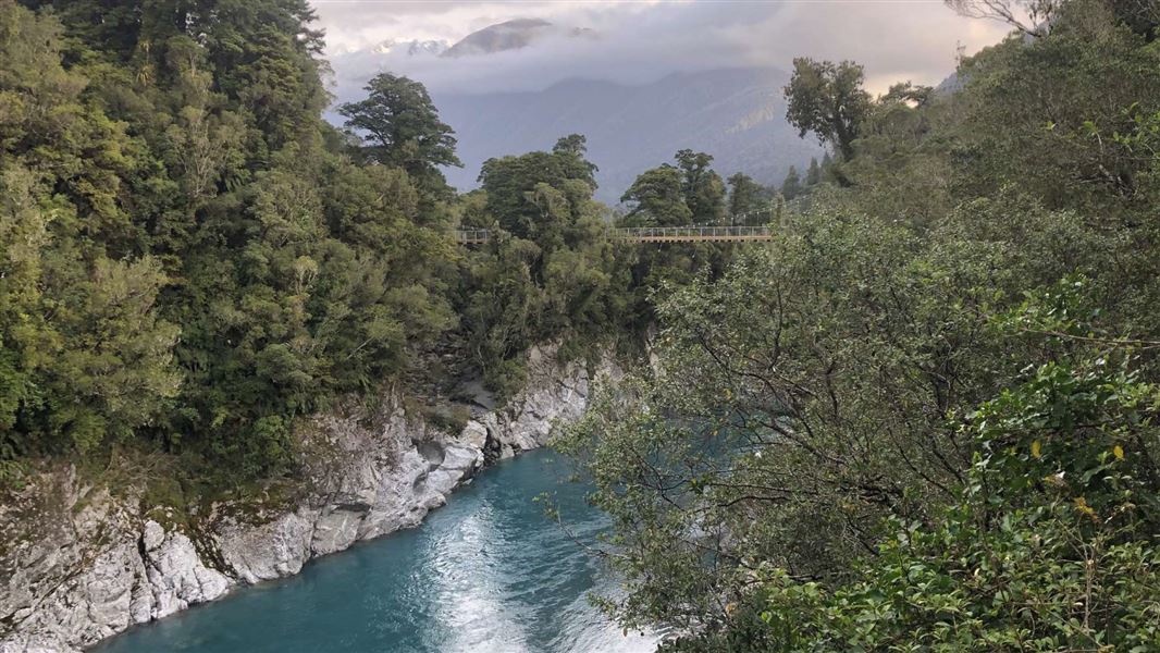
Enjoy these short walks showcasing the stunning Hokitika Gorge and the pristine mature podocarp forest of the Hokitika Scenic Reserve.

Due to the closure of the Hokitika Gorge lower suspension bridge, two walking tracks are available. Both descriptions and times are one way.

Hokitika Gorge Viewpoint

Distance: 150 m
Time: 4 min

From the interpretation shelter, follow the walking track for a few minutes through dense podocarp/hardwood forest before emerging onto a viewing platform. From here you can look down to the stunning Hokitika Gorge and out to the lush farmland of Kowhitirangi. This part of the track is accessible for wheelchairs. Return to the carpark the way you came.

Hokitika Gorge Track

Distance: 1.2 km 
Time: 45 min

There are multiple viewpoints along this track, save some for your return to the carpark.  This track is accessible for wheelchairs with assistance.

From the western end of the carpark it’s an easy undulating 15 minute walk through mature nature forest to a viewpoint overlooking the river and farmland land of the upper Hokitika Valley.

After a further 250 m of wandering track, the Upper Hokitika Gorge Suspension Bridge enters the forest canopy of Miro, Rimu, and Kamahi as it passes over a flood channel and an island before crossing the main channel of the Hokitika Gorge. The bridge offers spectacular views of the Hokitika Gorge, mature forested surrounds and the foothills of the Southern Alps.

From the bridge the tracks follows the river edge, with a curved gantry providing further river views and the impressive structure of the upper Hokitika Gorge suspension bridge and mountains in the background.

After 5 minutes of easy walking the track crosses Elf Creek, where from the bridge you can see how the water has sculptured the granite bedrock.

Just past here a further viewing platform offers more views of the river and steep sided walls of the gorge.

The track continues to wind through mature forest with river views and curved boardwalks taking you past small waterfalls with the blue-green river glimpsed through the trees. 

The track continues for another 200 m through the bush, crossing a small bridge to a second viewing platform looking out to the gorge, both up and down stream. Access to a small beach is also available here. Be sure to take time to read the warning signs and close the gate after you. 

Return to the carpark the way you came.

Times and distances (one way)

  • Hokitika Valley viewpoint:  650 m,  15 min
  • Upper Gorge suspension bridge: 900 m, 30 min
  • Lower Gorge viewing platform: 1.2 km, 45 mins

Hokitika Gorge Scenic Reserve is 33 km east of Hokitika. Leave Hokitika's main road by turning inland onto Stafford St which become Kaniere Rd, then Kaniere-Kowhitirangi Rd. South of Kokatahi the road turns sharp left, then sharp right. Turn left into Johnston Rd, right into Nielson Rd, and left into Whitcombe Valley Rd.

Swimming and river danger

Hokitika River, despite its often calm appearance, is swift, deep, cold, and dangerous in all weather and river conditions. There are sudden drop offs and strong currents.

Swimming is not advised. People have drowned here. Swimming here endangers your life and the lives of others in any rescue attempt. Don’t make a fatal mistake.

Keep to the track at all times

There are fall hazards along the length of this walk.

Stay away from the rock edges. The rocks are uneven and can be slippery. Take great care to avoid slipping and falling into the river.

Supervise children at all times

Your safety and that of your family is your responsibility.