November to December Isthumus Peak Track and Glen Dene Track are annually closed for fawning between 20 November and 20 December.
March to May Safari hunting takes place on Glen Dene Station. Be alert and stay visible, especially during the March to May roar hunting season.
Public foot or mountain-bike access, using an easement over private land, is from the carpark on State Highway 6, 30 minutes drive from Wānaka. From the carpark, the track gives access to 1385-metre Isthmus Peak and crosses the undulating skyline ridge to Matatiaho Conservation Area.
Isthmus Peak and Glen Dene Ridge tracks
Access from Stewart Creek
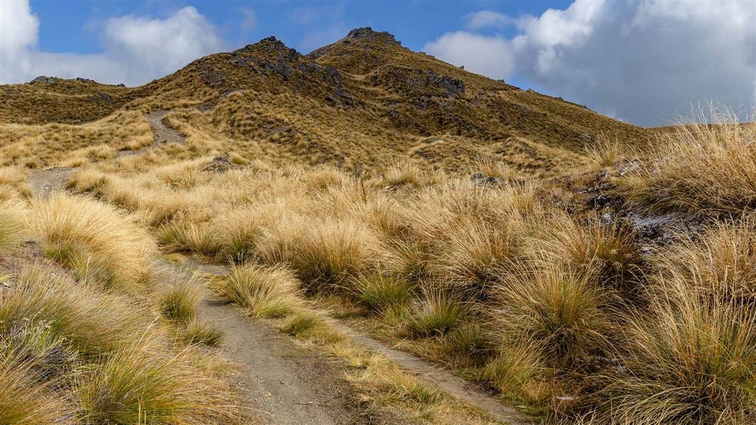
From the car park, follow the poled route on the true right of Stewart Creek, until it joins a 4WD track. From here a steep, rocky climb winds upwards to a skyline ridge. On many sections bikers will have to dismount. On reaching the ridge, a sign points to the Isthmus Peak Track on the right, and on the left, the ridge track to the conservation area. The track along the tops traverses a number of unnamed peaks.
There is no public access beyond the conservation area. Return to the car park by the same route. The track is closed for fawning, 20 November – 20 December.
- Car park to Isthmus Peak: 3-4 hr, 8 km
- Car park to Conservation Area: 5-7 hr 1 5km
Access from Craig Burn
A pleasant picnic spot is located on a walking track from the carpark to the lower Craig Burn. There is no formed track above this point on the conservation area, access is via scrubby, steep and rocky terrain
Access to Matatiaho Conservation Area was negotiated in 2008, and crosses Glen Dene, a working highcountry farm. Respect this by staying on the marked track, leaving gates as you find them and using stiles where provided.
It is recommended that you carry topographical maps NZTopo50 CA12 Minaret Bay and CA13 Lake Hawea.
Extreme conditions
In summer, very hot and dry conditions are common. Water is limited, carry a sufficient supply and have adequate sun protection.
Alpine conditions can occur at any time of year. Hypothermia is a real risk even in summer. Be prepared by having warm, waterproof, windproof clothing and the appropriate footwear. Whiteout conditions caused by snow or low cloud may be present.
Matatiaho Conservation Area has challenging avalanche terrain.
Check the Mount Aspiring National Park weather forecast – NIWA website.
Camping
Camping is permitted in the Matatiaho Conservation Area, but open fires are not allowed.
Safari hunting
Safari hunting operates on this station. Give way to game animals, especially during the roar – March to May.
Stay safe when crossing rivers
If you plan to cross unbridged rivers, know how to cross safely and be prepared for if you cannot cross.
Do not cross if the river is flooded, you cannot find safe entry and exit points or are unsure it’s safe. Turn back or wait for the river to drop. If in doubt, stay out.
There may be avalanche danger
Avalanches usually occur from May to November in Wakatipu, Wānaka and Central Otago. There can also be avalanches outside this period, if there is still snow coverage.
If you are going into avalanche terrain, always:
- Have the relevant avalanche skills and training.
- Check the ATES rating and the New Zealand Avalanche Advisory.
- Go with a buddy. Both of you should carry and know how to use an avalanche transceiver, a snow shovel and a probe.
Wānaka Tititea/Mount Aspiring National Park
Visitor Centre
| Phone: | +64 3 443 7660 |
| Email: | wanakavc@doc.govt.nz |
| Address: | 1 Ballantyne Road Wānaka 9305 |
| Hours: | Visitor centre hours and services |
