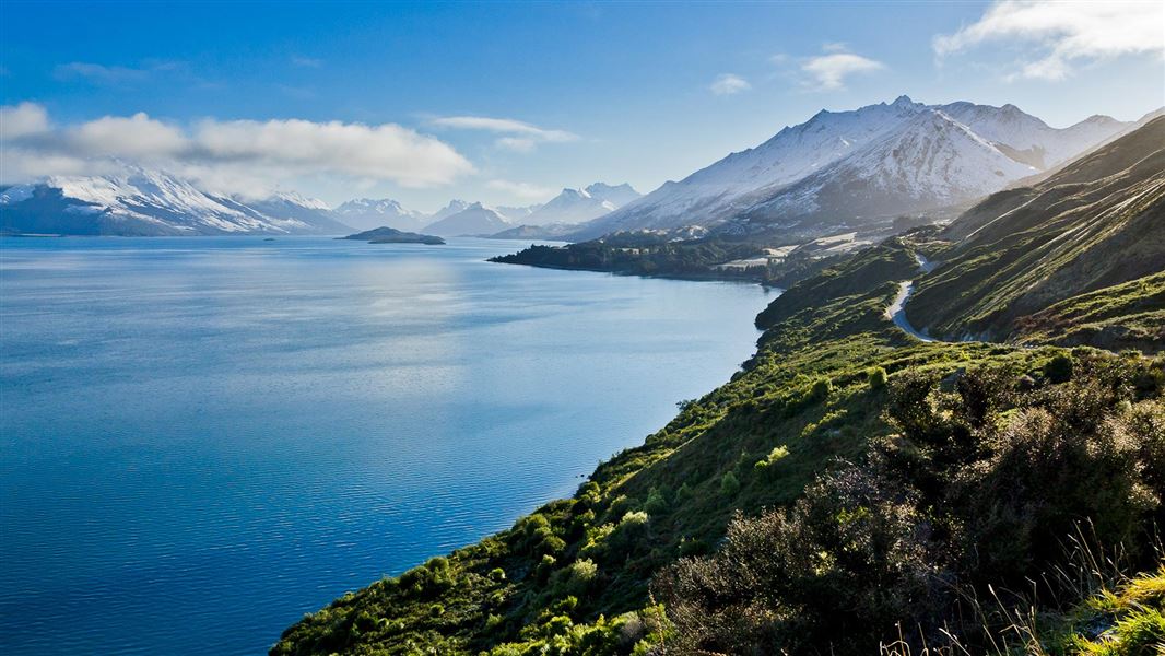
The region has a rich history of both gold mining and settlement. Several walks follow goldfield trails that enable you to explore and enjoy the outstanding scenery at the same time.
The Queenstown area was a location for Ithilien camp and the Argonath on the Anduin River - see Lord of the Rings film locations.
Brochures
Seasonal restrictions
All year round fires and fireworks are strictly prohibited in the ‘red zone’ determined by the Queenstown Lakes District Council. For details about the ‘red zone’ see Queenstown Lakes District Council's permit webpage.
Visit Whakatipu-wai-Māori/Queenstown Visitor Centre for local outdoor knowledge.
Fires should only be lit in established fireplaces; keep them small and have water nearby. Do not cut down or use live vegetation, and ensure sure that the fire is out before leaving the area. We recommend that trampers use gas stoves for cooking.
Gold fossicking
You can only fossick for gold in designated areas. Only hand-held tools are allowed. More on gold fossicking areas and rules.
All drone use must be authorised by DOC
You must have a permit to fly a drone on public conservation land.
Visit our Drone use on conservation land page for more information.
During the last ice age a glacier gouged Wakatipu’s lake bed to as deep as 380 m. Evidence of earlier glaciers can be seen on the slopes of adjacent Cecil Peak as deep scratches or striations. Initially the lake drained through the terminal moraine at Kingston at the southern end, as the Kawarau River outlet at Frankton is of comparatively recent origin.
The spectacular Remarkables Range beyond Frankton was formed by faulting and folding the schist rock to such an extent that many of the rock faces are almost vertical.
Lake Wakatipu is unique in New Zealand lakes as its level rises and falls throughout the day. This fluctuation of about 20 cm in Queenstown Bay is called a seiche. It’s thought to be caused by variations in temperature and atmospheric pressure, and is very noticeable at Bob’s Cove. Southern Maori describe this as the heartbeat of the giant, whose body forms the lakebed – his head at Glenorchy, knees at Queenstown and feet at Kingston.
The lake is basically an ice-scoured trough with an average depth of 360 metres. Above this the glaciers once rose as much as 1,000 metres above the lake’s present level. The glacier retreated at the end of the last ice age and the streams formed since then have deposited a lot of gravel along the lake’s shores. The alluvial material in Five, Seven and Twelve Mile Creeks has been worked for alluvial gold.
Maori first came to this area through the valley systems of Southland and Otago, in search of food, fibre and stone. They hunted the large, flightless moa and discovered pounamu (greenstone) at the head of Lake Wakatipu. Their visits continued to the middle of the 19th century, as permanent settlement was generally limited, though a few groups would stay for two or three years before returning to the coast.
The Gardens Peninsula was the site of a Maori Pa occupied by the people of the Katimamoe tribe. Maori legend tells of the first woman to swim across Lake Wakatipu, a distance of some 3 kilometres. Hakitekura, daughter of Tuwiriroa, a Katimamoe chief, asked for a kaueti or firestick and a dry bunch of raupo. To keep them dry, Hakitekura bound them in flax and early next morning, set out across the lake. She navigated by Cecil and Walter Peaks whose tops, touched by dawn’s first light, ‘twinkled and winked’ at her, hence their name Ka-kamu-a-Hakitekura – the twinklings seen by Hakitekura. She landed on Refuge Point (Te Ahi-a-Hakitekura) and lit a fire which, the legend says, is why the rocks there are black to this day.
In 1860 W. G. Rees and Nicholas Von Tunzelman arrived to develop the region’s pastoral potential. They burned much of the beech forest and shrubland to open it up for grazing. Later, trees such as Douglas fir, larch, sycamore, willow and poplar were planted to ‘enhance the barren landscape.’ Fir thrives in these conditions and has invaded the alpine tussock land, to the extent that wilding tree control is now necessary.
Thomas Low and John MacGregor discovered gold in the Arrow River in 1862, followed by discoveries in the Shotover. The gold rush peaked in 1863, when W.G. Rees’ leasehold was cancelled and a goldfield declared, for which he received £10,000 compensation. By 1865, though, the Westland gold rush had begun and the mass exodus of miners left two-thirds of Queenstown’s buildings vacant.
Up to this time gold was recovered from alluvial deposits, but new mining methods led to quartz crushing and by the 1870s gold was being mined from the quartz reefs of Macetown, Mt Aurum and the Shotover River. In the 1930s gold mining was revived as a result of the hardships of the Depression. More recently heavy machinery has been used to rework alluvial river bed deposits.
At the height of the gold rush, transport to Queenstown was chiefly by boat from Kingston, and the stately twin-screw steamer, Earnslaw, is an echo of those days. Commissioned in 1912, the Earnslaw maintained a regular service for the sheep stations bordering the lake. And prior to the opening of the Queenstown-Glenorchy Road, regular stopovers and picnic excursions to Bob’s Cove were serviced by lake steamers.
A pack track or bridle trail was developed between Queenstown and Glenorchy for a cheaper way of moving stock to and from the head of the lake. Some of the tracks described in the tracks and walks section on this site follow parts of these early routes.
Whakatipu-wai-Māori/Queenstown Visitor Centre
| Phone: | +64 3 442 7935 |
| Email: | queenstownvc@doc.govt.nz |
| Address: |
50 Stanley Street |
| Hours: | Visitor centre hours and services |
