29.24 km one way
Snow covers much of the track from May – November
Image gallery
Note: There is no exit on the Mitre Rocks/Lowburn side, trampers must return same way or use alternate exits described here.
Start at Queensberry car park and climb the Pisa Range Ridge Track. The track starts with a steady climb through farmland, up past the Alfern Creek Conservation Area and its small remnant grove of kānuka and Hall’s tōtara.
Climb over the stile into the Pisa Conservation Area and follow the farm track towards the trig at 1,444 m altitude. Continue along the ridge track, staying right at the junction with Locharburn Track.
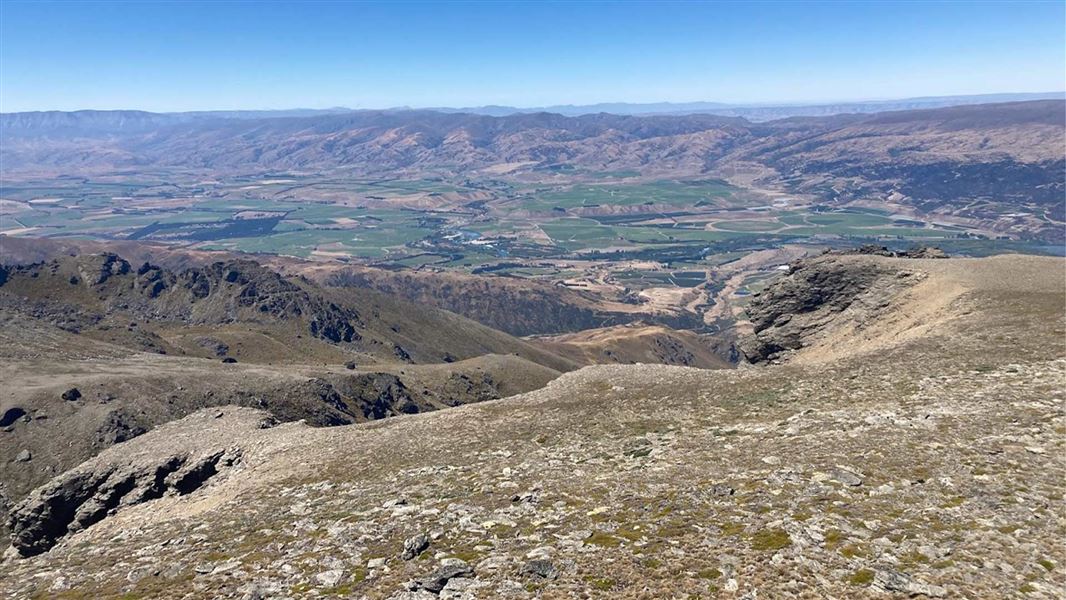
The next point of interest is Lake McKay, one of the most scenic views in the Pisas. At the junction with Kirtle Burn Track, veer left towards Mt Pisa. At 1963 metres, Mt Pisa is the highest peak in the range, offering expansive views over the Upper Clutha, Central Otago, and the Southern Alps (including Tititea / Mt Aspiring).
Continuing south on the ridgeline, keep right at the junction for Tinwald Burn Ridge Track. Soon you will see The Column Rocks, a striking geological feature of rock tors characteristic of the Pisa Range terrain.
The track continues past Mt Dottrel at 1690 metres, and terminates at the Pisa Range Conservation Area boundary just before Mitre Rocks. This is a long, challenging track that should only be attempted by well-prepared parties.
Alternative entry/exit points to the Pisa Range Ridge Track
- Tinwald Burn Ridge Track
- Locharburn Track
- Kirtle Burn Track via Snow Farm. During Snow Farm’s winter operating season, a pass is required to use Snow Farm tracks
- Cardrona-Cromwell Pack Track
Visitors wanting to connect the Pisa Ridge Track to Deep Creek Hut and the Cardrona-Cromwell Pack Track must stay on public conservation land. Previous maps from DOC indicated a trail connecting Deep Creek Hut to the Pisa Ridge via Mitre Rocks. However, this is on private property.
Check your route by going to DOC maps, and under DOC features, tick 'Public conservation areas'. Contact the Wanaka Visitor Centre with any questions.
Mountain biking
The 4WD track can be rutted and muddy. Some sections are very steep. Much of the track is rocky and bumpy.
- From Wanaka, drive 20 km south on SH6.
- Turn right on Pukekowhai Drive and drive up to the T junction at the top.
- Turn left on Wailana Heights Drive.
- You will reach Queensberry carpark on your right.
- If accessing via the Kirtle Burn Track, there is a locked gate at the bottom of the Paddys Ridge Road/Waiorau Nordic Road. To get the gate code follow the website link/QR code posted at the gate. There is a $20 road toll payment required. See Pisa Ranga Road Access to get the gate code online and pay.
There are no toilets or other facilities on this track, and water sources are not reliable.
Adverse weather
The weather can change rapidly in New Zealand. Hypothermia is a real risk even in summer. Whiteout conditions caused by snow or low cloud may be present. This ridgeline is also prone to severe winds.
Be prepared by having warm, waterproof, windproof clothing and the appropriate footwear. In summer, very hot and dry conditions are common. Carrying an adequate supply of both drinking water and sun protection is essential.
Check the Roys Peak weather forecast – NIWA website.
Avalanche risk
This area has terrain that can produce avalanches that cross the track, usually from May into November.
Private property and permissions
This track crosses private land. There is no camping until the conservation area boundary.
Respect the landowner's livestock and property:
- stay on the marked track until you reach the conservation land
- leave gates as you find them
- use stiles where provided
- keep your distance from livestock
Firearms
Firearms are not permitted on easements through private property. Entry to Pisa Conservation Area with a firearm is only allowed via Rock Peak Track.
Dog access
Dogs are not permitted on this track. Dogs are allowed in the Pisa Conservation Area, but entry/exit is restricted to the Crown Saddle Carpark access. All other entry points are via easements through private property and require landowner permission to enter with a dog including transporting them in vehicles.
Stay safe in the outdoors
- Choose the right trip for you. Learn about the route and make sure you have the skills for it.
- Understand the weather. Check weather forecasts.
- Pack warm clothes and extra food. Check gear lists.
- Share your plans and take ways to get help. Leave your intentions with a trusted contact and take a distress beacon.
- Take care of yourself and each other.
Wānaka Tititea/Mount Aspiring National Park
Visitor Centre
| Phone: | +64 3 443 7660 |
| Email: | wanakavc@doc.govt.nz |
| Address: | 1 Ballantyne Road Wānaka 9305 |
| Hours: | Visitor centre hours and services |
