12.38 km loop
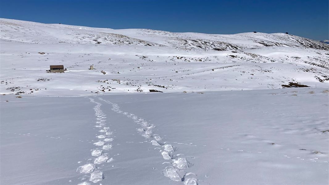
In winter (May - October) this track is often covered by snow. The route may also be completed by snowshoe or touring skis for people with the appropriate skills, equipment, and experience.
See 'Know before you go' for information on adverse weather and avalanche conditions.
Image gallery
Kirtle Burn Track starts at the western end of the Pisa Conservation Area. Access from Paddys Ridge Road/Waiorau Nordic Road is through Snow Farm or Southern Hemisphere Proving Grounds (see Getting there.)
The upper loop of the track starts with a steep zig-zag track, gaining a ridge line that can be followed most of the way to Mt Pisa. A turn-off from the track drops down to Kirtle Burn Hut. From the hut, the lower trail following the Roaring Meg/Kirtle Burn can be used to finish the loop, returning to the Pisa Conservation Area boundary.
The lower part of the loop along the river crosses the stream twice – take care if coming downhill by mountain bike, or in snow conditions which may conceal the streams.
This track can also be used to link with the Pisa Range Ridge Track and to access Mt Pisa.
Mountain biking
Kirtle Burn Track is accessible by mountain bike in summer. For a larger biking trip, it can also be connected to the Pisa Range Ridge Track. Some parts of the trail can be very rocky and some cyclists may choose to walk some sections. Take care going downhill via the lower Kirtle Burn Track, where two stream crossings are required.
Fees
Fees for road use, parking, and/or Snow Farm trail passes may apply. See “Getting there.”
Access to Kirtle Burn Hut
Access is from Paddys Ridge Road/Waiorau Nordic Road, this is a 13.5 km, high altitude gravel road. The road is not maintained during summer. Chains may be required in winter.
The Paddys Ridge Road/Waiorau Nordic Road is 22 km from Wanaka off the Cardrona Valley Road. In summer there is a locked gate at the bottom. To get the gate code follow the website link/QR code posted at the gate. A $20 road toll payment is required. See the Pisa Range Road Access Gate website to get access and pay.
Access to Pisa Conservation Area
Access is either through Snow Farm trails or the Southern Hemisphere Proving Grounds. Note: Snow Farm access is about double the distance of the Southern Hemisphere Proving Grounds.
Snow Farm
Park in car park provided between the SHPG building and Snow Farm building.
Summer (mid-September – late-May)
- Accessing Pisa Conservation area via the legal easement through SHPG grounds. To get the gate code to Paddys Ridge Road/Waiorau Nordic Road see the Pisa Range Road Access website to pay.
- Accessing the Pisa Conservation area via the Snow farm trails, a $10 koha/donation would be appreciate to go toward trail maintenance. Pay the Summer Trail Koha Donation (under the Summer Product or Donation tabs).
Winter (June-September)
- Accessing the Pisa Conservation Area via the Snow Farm trails: fees are $10 for a Backcountry Access Pass per person per day or buy a season pass. Available at the Snow Farm ticketing office or buy online.
- Accessing Pisa Conservation Area via the legal easement through SHPG grounds: Go to security booth on arrival, pay $20 road toll, then be escorted through the SHPG grounds. For more information, contact: admin@shpg.co.nz or call +64 3 443 0344
Adverse weather
The weather can change rapidly in New Zealand. Hypothermia is a real risk, even in summer.
Whiteout conditions caused by snow or low cloud may be present. The Pisa Range is also prone to severe winds.
Be prepared by having warm, waterproof, windproof clothing and the appropriate footwear.
In summer, very hot and dry conditions are common. It is essential to carry an adequate supply of drinking water and sun protection.
Check the Roys Peak weather forecast – NIWA website.
Avalanche risk
This area has terrain that can produce avalanches that cross the track, usually from May into November.
Private property and permissions
Access to the Western side of the Pisa Conservation area is gained either through Snow Farm or Southern Hemisphere Proving Ground. See Getting there.
The Southern Hemisphere Proving Ground operates year-round, so be aware of moving machinery and vehicles in the Snow Farm Lodge car park at all times. Access roads adjacent to the estate area are used for vehicle testing, extreme care is required. Photographs or recording devices are not permitted, this includes the use of unmanned aircraft systems/drones.
Respect the landowner's property. Stay on the marked track until you reach the conservation land.
Firearms
Entry to Pisa Conservation Area with a firearm is only allowed via Rock Peak Track.
Dog access
Dogs are allowed in the Pisa Conservation Area, but entry/exit is restricted to the Crown Saddle car park access.
All other entry points are via easements through private property and require landowner permission to enter with a dog - including transporting them in vehicles.
Stay safe in the outdoors
- Choose the right trip for you. Learn about the route and make sure you have the skills for it.
- Understand the weather. Check weather forecasts.
- Pack warm clothes and extra food. Check gear lists.
- Share your plans and take ways to get help. Leave your intentions with a trusted contact and take a distress beacon.
- Take care of yourself and each other.
Wānaka Tititea/Mount Aspiring National Park
Visitor Centre
| Phone: | +64 3 443 7660 |
| Email: | wanakavc@doc.govt.nz |
| Address: | 1 Ballantyne Road Wānaka 9305 |
| Hours: | Visitor centre hours and services |