Oteake Conservation Park
Located in the Canterbury and Otago regions
|
Introduction
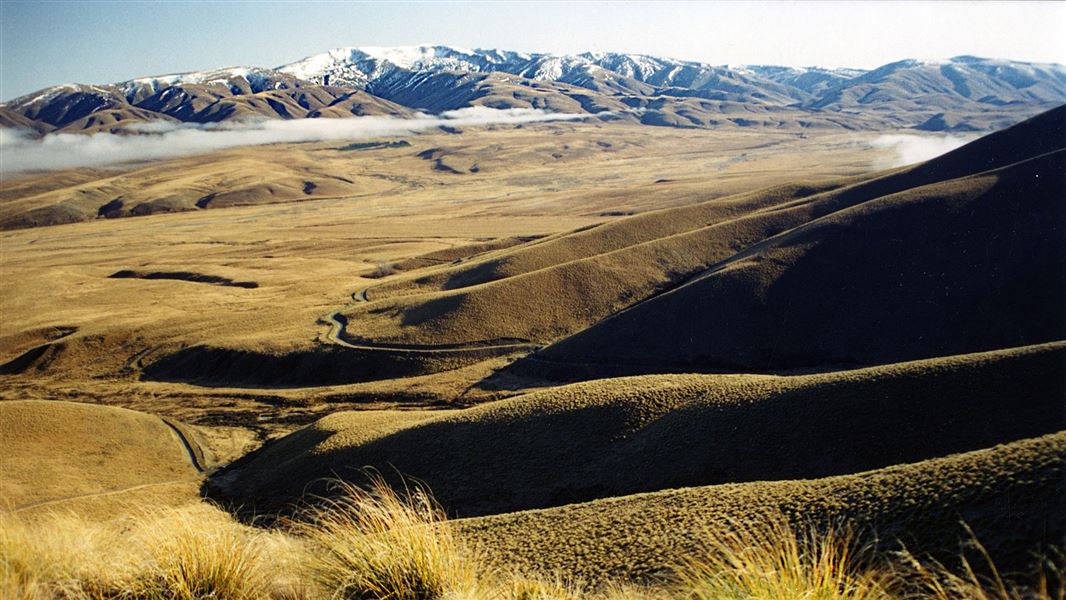
Oteake Conservation Park covers large tracts of the St Bathans, Ewe, Hawkdun, Ida and St Marys ranges, and parts of the upper Manuherikia Basin.It protects outstanding landscapes including mountainous high country, tussock plateaux, scree, wetlands and indigenous shrubland.
You can visit the historic Buster Diggings, and explore spectacular sculptures created by gold mining and stay overnight in Ida Railway Hut, a former high country mustering hut.
Find things to do and places to stay Oteake Conservation Park
The East and West Manuherikia are not a through road for vehicles from 1 May to Labour Weekend - vehicles can drive to Boundary Creek Hut and Top Hut but not beyond during this period. There is a locked gate on the Omarama side of the conservation area.
Oteake is a fantastic for a multiday horse trek through vast scenic high country tussocklands. The huts have holding paddocks (corals) for horses. Either saddle pack or get a support 4WD vehicle to bring in food and overnight supplies.
There are several access points on both the Otago and Canterbury sides of the park, the mains one being carparks at Hawkdun Runs Road, Falls Dam, Home Hills Run Road, Mt Buster Road in the Maniototo, and on Broken Hut Road from the Waitaki Valley.
Much of the public access into the park is along easements crossing private land. Please respect this by driving carefully, keeping to tracks and roads, and leaving gates as you find them.
4WD access: East Manuherikia Road is open from Labour weekend until 30 April annually.
The West Mauherikia Road is not a through road from 1 April to Labour Weekend. Vehicles can drive from Boundary Creek Hut to Top Hut but not beyond during this period.
In summer hot, dry conditions are prevalent. Carry plenty of water. Alpine conditions may occur at any time of year. An avalanche risk may exist between May and October.
Treat all rivers and streams with respect. Be aware of recent weather conditions. Do not attempt to cross swollen rivers or streams.
Fire restrictions apply. Check with the local information centre or DOC office for current fire status.
Mobile coverage is not reliable in the park. Satellite phones, mountain radios or personal locator beacons increase personal safety.
There may be avalanche danger
Avalanches usually occur from May to November in Wakatipu, Wānaka and Central Otago. There can also be avalanches outside this period, if there is still snow coverage.
If you are going into avalanche terrain, always:
- Have the relevant avalanche skills and training.
- Check the ATES rating and the New Zealand Avalanche Advisory.
- Go with a buddy. Both of you should carry and know how to use an avalanche transceiver, a snow shovel and a probe.
Within Oteake, Otago species often reach their northern limits and, similarly, Canterbury species reach their southern limits. The park protects numerous communities, including threatened plants: cypress hebe, native broom – coral and dwarf – Ranunculus acraeus and scree pea. The dominant vegetation is narrow-leaved tussock, found in a wide range of altitudes and situations.
Oteake’s diverse habitat hosts a range of bird species, from grey warbler/riorio in the shrublands to threatened, braided riverbed species: banded dotterel/tuturiwhatu, black-billed gull/karoro, black-fronted tern/tarapiroe and occasional black stilts/kakï.
Oteake is an oasis for lizards, including various skink and gecko species, many of them threatened or uncommon. Invertebrates include moths, grasshoppers, weevils and spiders – in alpine areas they often reach giant sizes.
Kāi Tahu believe that Oteake, 'place of the ake', is named for the ake ake; probably Olearia avicenniaefolia, a conspicuous shrub daisy found on both sides of the park. Oteake is also the indigenous name for both the Kye Burn and a stream on the other side of the range.
Oteake was important to tangata whenua from coastal Otago kāika/settlements as mahika kai– places where food was obtained. Weka were hunted and plants gathered. Stone quarries in the Upper Manuherikia, are further evidence of iwi activity. This is why Oteake is so-named. None of the European names for the area encompass its full extent.
Oteake’s European history began when pastoral leases were issued throughout the South Island high country in the 1850s, creating large lease-holdings such as Hawkdun, Omarama, Otekaike and Morven Hills Stations. Over time they were sub-divided, and more recently, produced land through tenure review and property purchase to become Oteake Conservation Park.
In the 1860s, gold was found within Oteake, at Guffies Creek and on the flanks of Mt Buster. At 1200 metres, the Buster Diggings became the country’s highest altitude gold workings. Further evidence of Oteake’s gold mining past is the network of water races, including the Scandinavian Water Race feeding the St Bathans workings and the Mount Ida Government Water Race.
Contacts
Wānaka Tititea/Mount Aspiring National Park Visitor Centre |
|
---|---|
Phone | +64 3 443 7660 |
wanakavc@doc.govt.nz | |
Address | 1 Ballantyne Road Wānaka 9305 |
Hours | Visitor centre hours and services |