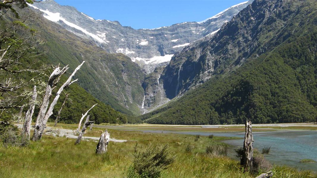
The main track up the East Branch of the Matukituki River provides several options. It connects with a side track to the Glacier Burn, and continues up the river to Junction Flat.
From Junction Flat there's a side route to the Kitchener Valley and Rock of Ages Biv.
There is also the option of the route up the true left of the river's East Branch to Ruth Flat and a traverse over the range to the Wilkin Valley. This should only be attempted by experienced parties.
The grassy river flats are leasehold farm land. Respect this and do not disturb the stock.
Cameron Flat to Glacier Burn
Time: 4 hr return
Distance: 10 km
Ford the Matukituki River at Cameron Flat. If the river is high use the Otago Boys High Bridge, one hour upstream on the river's West Branch. Beyond the old Mount Aspiring Station homestead the track passes through beech forest, climbs to a saddle and descends to the Glacier Burn.
The track leads up the burn's true right, before the bridge, There are spectacular bluffs and waterfalls at the head of the valley, though there is no formed track beyond the river.
Cameron Flat to Rock of Ages Biv
Time: 8 hr
Distance: 24 km
Cameron Flat to Junction Flat
Time: 5 hr return
Distance: 19 km
After reaching and crossing the Glacier Burn the track runs parallel to the East Branch to reach Junction Flat and the Kitchener River. Expect muddy sections and several major slips to cross.
Junction Flat to Rock of Ages Biv
Time: 3 hr return
Distance: 5 km
This track follows the true right of the Kitchener River and climbs an old unstable slip which is narrow with a drop off on one side. Markers are known to move because of slips and care is required when crossing this section. The track passes through beech forest to the top of the gorge. There are spectacular views of the Kitchener Cirque from Aspiring Flat. The Rock of Ages rock biv is 30 minutes past Aspiring Flat, 20 metres above the flats and in bush near the head of the flats.
The East Matukituki Valley is a one hour drive west from Wanaka; the last 35 km is on a gravel road. The turn-off to the Cameron Flat carpark, on the right, is signposted.
Flooding: The Kitchener Valley is prone to flooding in heavy rain and can become inaccessible.
Weather: Unpredictable weather patterns mean that snow, strong winds and heavy rain can occur at any time of year. Although the valleys are not closed in winter, snow may make travel difficult and dangerous.
Swing bridges
There's a limit to the number people allowed on the swing bridges at any one time – be prepared to wait at each end if numbers allowed have been reached.
Be avalanche alert
This area has terrain that can produce avalanches that cross the track, usually from May into November. View avalanche information and the terrain rating for this track.
Private property and permissions
This track crosses private land. There is no camping until the conservation area boundary.
Respect the landowner's livestock and property:
- stay on the marked track until you reach the conservation land
- leave gates as you find them
- use stiles where provided
- keep your distance from livestock.
Wānaka Tititea/Mount Aspiring National Park
Visitor Centre
| Phone: | +64 3 443 7660 |
| Email: | wanakavc@doc.govt.nz |
| Address: | 1 Ballantyne Road Wānaka 9305 |
| Hours: | Visitor centre hours and services |
