Various up to 12 km one way
Young Australian Historic Reserve Road
Walking time: 4-5 hr
Distance: 12 km one way
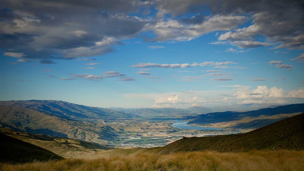
From the top of the Carrick Range, this road offers great views of Lake Dunstan and the Cromwell basin. This 4WD road goes through the Young Australian Historic Reserve, rich in gold mining history, as it descends in altitude from 1300 m near Duffers Saddle to 400 m at Quartzville Road.
Getting there: From the Nevis Road near Duffers Saddle, follow the Young Australian Historic Reserve Road for 4 km to the Young Australian Historic Reserve. Follow the road through the historic reserve, dropping down off the range to Quartzville Road and onto Bannockburn.
Warning! There are mine shafts in this area, stay on the formed road. The water races are privately owned, do not interfere with them.
Middle Potters Creek Track
Walking time: 40 min one way from the junction with Slapjack Saddle Track, 1 hr 30 min one way from Young Australian Historic Reserve Road along the Slapjack Saddle Track
Distance: 2.5 km from the junction with Slapjack Saddle Track
Middle Potters Track climbs to 1200 m altitude before dropping down to Potters Creek Conservation Area boundary.
Getting there: Middle Potters Track branches off Slapjack Saddle Track, 2 km from the start of Slapjack Saddle Track on the Young Australian Historic Reserve Road. It's 4.5 km along the Young Australian Historic Reserve Road (off Nevis Road, near Duffers Saddle) to the start of the Slapjack Saddle Track.
Upper Pipeclay Track
Walking time: 1 hr - 1 hr 30 min one way from Young Australian Historic Reserve Road
Distance: 4 km one way
This is a high altitude 4WD track that starts at its highest point at about 1200 m altitude. It has steep and difficult sections. It initially follows the Potters Creek Conservation Area boundary and provides access to the Long Gully/Mt Difficulty Conservation Area.
No horseriding on this track.
Getting there: Upper Pipeclay Track branches off Slapjack Saddle Track, 1 km from the start of Slapjack Saddle Track on Young Australian Historic Reserve Road. It's 4.5 km along the Young Australian Historic Reserve Road (off Nevis Road, near Duffers Saddle) to the start of the Slapjack Saddle Track.
Upper Potters Creek Track
Walking time: 2 hr one way
Distance: 7.5 km one way
This high altitude track starts at the Nevis Road at 1130 m and meanders through tussock country before reaching a junction with South Potters Track. Turn right to stay on Upper Potters Creek Track, which continues to descend, then follows a stream before climbing up to meet with the Young Australian Historic Reserve Road.
Getting there: The track starts on Nevis Road, 2.5 km west of Duffers Saddle. 4WD vehicles can also access the other end of the track - turn off Nevis Road onto the Young Australian Historic Reserve Road, and travel 4 km to the start of the track.
South Potters Creek Track
Walking time: 30 min one way from the junction with Upper Potters Creek Track, 1 hr 30 min from Nevis Road along the Upper Potters Creek Track
Distance: 2 km one way from the junction with Upper Potters Creek Track
This track meanders at around 1000 m altitude through open tussock county on a well marked farm road. From the Upper Potters Creek Track junction, the South Potters Track follows along the top of the range descending to reach the southern boundary of Potters Creek Conservation Area.
Getting there: South Potters Creek Track branches off the Upper Potters Creek Track, 3 km from the start of Upper Potters Creek Track on Nevis Road (2.5 km west of Duffers Saddle).
Four wheel driving
You can 4WD on the Young Australian Historic Reserve Road.
Most of the tracks in this area cross private property - stay on the tracks and roads and leave gates as you find them.
This is a very dry area with no water on the tracks - take water with you.
There are no designated campsites or huts in this area - do not camp on private land.
Remember that all rocks, historic artefacts (including earth and stone works), native plants and animals are protected on public land - tread carefully and take only photos.
Stay safe in the outdoors
- Choose the right trip for you. Learn about the route and make sure you have the skills for it.
- Understand the weather. Check weather forecasts.
- Pack warm clothes and extra food. Check gear lists.
- Share your plans and take ways to get help. Share directly or use the Outdoor Intentions form or Plan My Walk. Take a distress beacon.
- Take care of yourself and each other.
DOC Customer Service Centre | |
---|---|
Phone | 0800 275 362 |
alexandra@doc.govt.nz | |
Address | DOC offices |