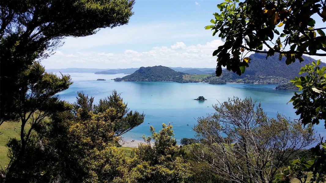
- Some of the best coastal forest in the North Island.
- Magnificent coastal panorama views.
- Ruins of a WWII radar station.
- Fitness required: Moderate to high
- Gradient: Steep and undulating
7.5 km one way
Video
Te Whara Track follows an ancient Māori trail from Ocean Beach to Urquharts Bay. The track passes through some of the best coastal forest in the North Island.
This is a challenging day walk that requires moderate to high fitness. There are many stairs and it is very slippery after rain. There are steep drops-offs, so stay on the track and supervise children. Smugglers Bay Loop Track is a shorter and easier alternative in the same area.
Te Whara Track starts at Ocean Beach car park on Ranui Road. It climbs steeply, with sections of stairs.
It climbs steadily until it reaches a picnic table, near the ruins of a WWII radar station. The track then climbs to the Bream Head summit. There are stunning views of Cape Brett (Motukokako), Cape Rodney (Tawharanui) and islands.
After the Bream Head summit, the track follows the ridge, passing the turnoff to Peach Cove Hut. The track leads along the ridge to the summit of Mt Lion. It then descends steeply and meets the loop track to Smugglers Bay. The track ends at the Urquharts Bay car park.
There are toilets at Urquharts Bay car park, Ocean Beach car park and Peach Cove Hut, but no toilets on the track in between.
To minimise disturbance to the area, and out of respect to local iwi and their ancestors, do not leave the marked tracks.
The nearest town is Whangārei (38 km).
You can start the track from either Ocean Beach car park on Ranui Road or Urquharts Bay car park at the end of Urquharts Bay Road. The track is not a loop, so you will need to arrange transport.
If you don't want to walk the entire length of the ridge, you can park at the entrance to Peach Cove Track and enter/exit via that track.
Be ready for a challenging day walk
Te Whara Track is a full-day adventure that requires good fitness. It is 7.5 km and takes 5-6 hours one way, due to the substantial change in elevation (+/- 456 m).
There are many stairs and steep sections. You will also need to scramble over tree roots. The track can get very slippery and muddy, especially after rain. Wear sturdy footwear with good grip and we recommend choosing a dry day to walk the track.

There are steep drop-offs
There are steep drop-offs beside the track and on rocky outcrops. A fall could be fatal. Supervise children carefully.
What to take
Bring:
- plenty of drinking water (there is none along the track)
- lunch and snacks
- a water/windproof jacket, hat and gloves, and wear warm, layered clothing
- sun protection – sunscreen, sunglasses and a sunhat
- sturdy footwear with good grip, such as light hiking boots
- fully charged head torch and spare batteries
- mobile phone
- first aid, medication and emergency equipment.
How to pack for a day walk
There are a number of opportunities to see the recently translocated Whitehead/pōpokotea or the New Zealand robin/toutouwai.
Te Whara was the principal wife of the rangatira (chief) Manaia.
It was here that Manaia first met Puhi-moana-āriki, an early ancestor of the Ngāpuhi iwi and cautioned him with the words “Kei whara koe e Puhi i ngā tai e hāruru ana” (You may meet with disaster from the tides that thunder there).
Manaia’s wife is said to have slighted Puhi and was turned into stone. She stands as the projecting up-thrust rock at the eastern-most point of Bream Head, known as ‘Te Wahine iti a Manaia’.
Te Whara Track follows the ancient footprints of Manaia; a track that is at least 700 years old.
Stay safe in the outdoors
- Choose the right trip for you. Learn about the route and make sure you have the skills for it.
- Understand the weather. Check weather forecasts.
- Pack warm clothes and extra food. Check gear lists.
- Share your plans and take ways to get help. Share directly or use the Outdoor Intentions form or Plan My Walk. Take a distress beacon.
- Take care of yourself and each other.
Stop kauri disease and protect kauri
- Scrub all soil off shoes and gear.
- Use cleaning stations.
- Always stay on the track.
DOC Customer Service Centre
| Phone: | 0800 275 362 |
| Email: | whangarei@doc.govt.nz |
| Address: | Whangārei Office |
