Located in Tākaka area in the Nelson/Tasman region
Introduction
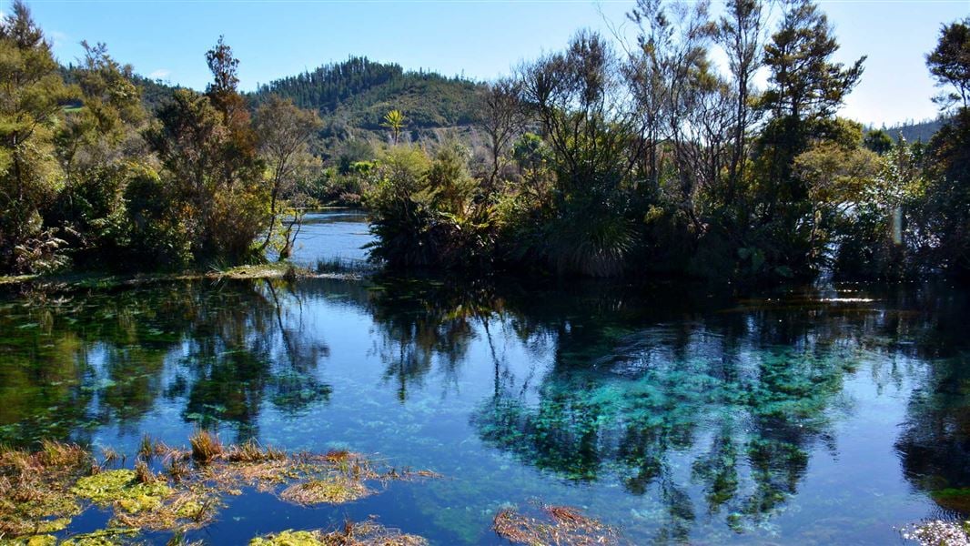
Te Waikoropupū Springs are the largest freshwater springs in New Zealand, the largest cold water springs in the Southern Hemisphere and contain some of the clearest water ever measured.Image gallery
Te Waikoropupū Springs and Te Waikoropupū Springs Scenic Reserve are located in the Tākaka Valley about six kilometres west of Tākaka Township.
Do not touch the water
The waters of Te Waikoropupū Springs, including Fish Creek and Springs River are closed to all forms of contact.
No fishing, swimming, diving, wading, boating, filling of drinking water containers, or any other activity where parts of the body or equipment contact the water.
Be careful of swift waterways
The cold, swift waterways of the springs reserve are dangerous – keep children under close supervision near the water.
No dogs allowed
Te Waikoropupū Springs (known as Pupū Springs), discharg 14,000 litres of water per second.
The qualities of the water from Te Waikoropupū Springs are of considerable scientific interest. In 1993, The National Institute for Water and Atmosphere (NIWA) carried out optical measurements under water and found that the visibility was 63 metres.
This is very close to optically pure water, with clearer water found only beneath Antarctica’s near-frozen Weddell Sea. The water clarity is a result of natural filtering prior to the water’s emergence at Te Waikoropupū Springs.
Tidal flux
The springs exhibit remarkable twice-daily fluctuations in flow. These correspond to local marine tides, despite the fact that the springs are 50 metres above sea level and there is no known connection to the sea. Scientists at NIWA have shown that the tidal effect is caused by both ocean-loading tides (the movement of the Earth’s crust in response to ocean tides) and Earth tides (the movement of the Earth’s crust as a direct result of gravitational attraction to the Sun and Moon). The possibility of a subterranean connection to the sea is suggested by chemical measurements showing that sea water is present in the discharge.
Forest in recovery
Most of Waikoropupū Springs Scenic Reserve is covered in mānuka and kānuka – indigenous plant 'pioneers' that re-colonise cleared forest areas and eventually make way for other species. This vegetation type reflects a history of disturbance by fire, gold mining, farming and road building. The reserve now has areas of regenerating beech-podocarp forest and a small remnant of tall podocarp forest to the south of Te Waikoropupū Springs. Besides tawhai (black beech), this area features rimu, kahikatea, tōtara, mataī and miro. Te Waikoropupū Springs is also a habitat for submerged mosses and liverworts, including at least one moss that is found nowhere else.
To local Māori, Te Waikoropupū Springs are a taonga (treasure) and wāhi tapu, a place held in high cultural and spiritual regard.
The waters of Te Waikoropupū Springs, including Fish Creek and Springs River, are closed to all forms of contact (including fishing, swimming, diving, wading, boating and drinking the water) to safeguard water quality and to respect cultural values.
Māori probably first visited this area over 700 years ago as part of a gradual expansion from Nelson through Tasman Bay/Te Tai-o-Aorere and Golden Bay/Mohua to the West Coast.
When Colonel William Wakefield arrived in 1839 to buy land for the New Zealand Company, he estimated that there were 250 people living in Mohua, representing the Ngāti Tama, Te Ātiawa and Ngāti Rarua tribes. Many of their descendants still live in Mohua and as mana whenua of Mohua, have traditional rights at Te Waikoropupū.
Early European settlers arrived in the Golden Bay area in the 1830s, mainly to build ships and mine for gold, coal and lime. Originally the area around Te Waikoropupū Springs was covered in lowland forest. Gold miners cleared the forest to build water races for sluicing alluvial gold and a mining company worked the area until about 1910.