From the DOC carpark at Matiri roadend follow the Lake Matiri Hut Track for 1.5 hr to Lake Matiri Hut.
1000 Acre Plateau
Lake Matiri Hut to Poor Petes Hut
Time: 3 hr
From the fork in the track just beyond Bay Creek a tramping track climbs abruptly up a spur. After about 40 minutes there is a good place for a rest and to take in the panorama of the Matiri Valley and lake below.
The track continues steeply through a diverse forest of silver and mountain beech, kamahi, rata and mountain totara. The plateau rim is reached in about two hours from Lake Matiri Hut - a huge expanse of tussock land dotted with patches of stunted forest. Beyond the rim a marked route sets out across the boggy-in-places plateau to Poor Petes Hut.
Poor Petes Hut to Larrikins Creek Hut
Time: 3 hr
The marked route from Poor Petes climbs to a high point of 1115 metres and then gradually descends a broad, undulating ridge, occasionally crossing limestone creek beds.
Approaching the steep slopes of The Haystack, the ridge narrows and tussock gives way to beech forest. Maintain the level gradient through the forest on a marked route before merging into clearings where Larrikins Creek Hut sits.
Day trips from Larrikins Creek Hut
Descending from the Devils Dining Table (The Needle in the background)
Image: James Gibson | Creative Commons
The hut is a good base for exploring the striking landscape features of the Devils Dining Table (or the Hundred Acre Plateau as it is also known) and the mudstone peaks of The Needle and The Haystack.
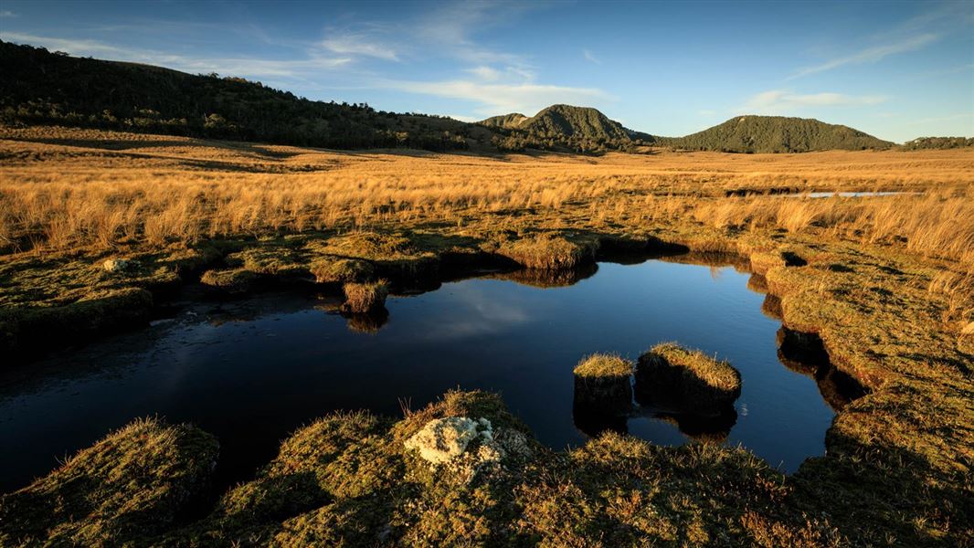
To reach the Hundred Acre Plateau climb the bushy gully to the north of the hut to a tussock basin with tarns. Sidle west out of the basin onto the plateau. On the western rim is a bump called Mt Misery. Its a good vantage point to survey the vast Mokihinui watershed to the west.
The Needle can be climbed either from the plateau or by continuing to the ridge above the tarns. Spectacular views of the Matiri plateau, Mokihinui watershed and the broken limestone Matiri Range are the reward.
For the agile a ridge traverse is possible from The Needle to The Haystack although there are some scrambly notches on the narrow ridge and should only be attempted with good visibility.
Larrikins Creek to the Mokihinui River
For experienced trampers Larrikins Creek provides access to the Mokihinui River and exit options to either Seddonville or Lyell. Both are major undertakings and are dependent on fine weather to cross rivers.
Upper Matiri Valley
Lake Matiri Hut to McConchies Hut
Time: 5 hr
Sidle around the western shore of the lake through beautiful beech forest. Just beyond the open flats where Bay Creek flows into the lake signs indicate the track to the 1000 Acre Plateau and the upper Matiri Valley.
Continue up-valley on river flats for several kilometres. Travel slows as the valley narrows, two steep climbs avoid gorge sections. McConchies Hut is about half way up Matiri Valley.
McConchies Hut to Hurricane Hut
Time: 6-7 hr
Beyond McConchies Hut, earthquake damage and diversion around obstacles on the valley floor make for slower going. Thirty minutes up river from the hut an unnamed side creek provides an arduous, unmarked route through bluffs to the tops near The Haystack.
Continue up-valley until another side stream on the true right is reached. Leave the main valley here and head up the stream. Jumbled scrubcovered rocks require careful marker spotting.
Eventually the track leaves the stream and climbs a slip to the ridge crest separating the side valley from the Matiri Valley. The track keeps to the ridge, eventually it drops off the western side of the ridge and emerges on to a boggy red tussock flat.
Skirt the margin of the flat and climb over a forested saddle to another smaller swampy flat on the other side. Descend into a limestone stream bed which is often dry and follow it down to rejoin the Matiri River.
A short climb leads to Lake Jeanette where drowned trees fringe a lake created by rockslides during the 1929 Murchison earthquake. Sidle the western shore of the lake and the western side of the now flat valley floor to reach Hurricane Hut.
From Hurricane Hut to Wangapeka Saddle
Time: 10-11 hr
This ridge top route should only be attempted by experienced parties with map and compass skills.
Fine weather is also an essential ingredient as the ridge twists and turns and is difficult to follow in fog.
A marked route climbs to point 1442 above Hurricane Hut. Beyond this point there are no markers. Most of the distance to the Wangapeka Saddle is above the bushline with only one tarn (north of point 1398) for a water stop. Panoramas of the Mokihinui and Wangapeka catchments and distant ranges of the Mt Owen massif, Mt Patriarch and Mt Kendal are superb.
Map BQ Wangapeka Saddle in the Topo50 series is the map required for this route.
Murchison, the gateway for southern Kahurangi National Park is about four hour's drive from Christchurch and 1.5 hours from Nelson.
About 6 km north of Murchison, (just north of the bridge over the Buller River), turn off SH6 onto Matiri Valley Road. Continue for about 16 km to reach the roadend carpark.
From Nelson, the Matiri Road turn off is 30 km past Kawatiri Junction.
The Matiri plateau and upper Valley are remote tramping experiences. Trampers need to carry and know how to use a topographic map.
NZTopo50 map sheet BR23 Murchison covers most of the area.
Trampers should be well equipped and fit. The terrain is often rough. Rain and flooded streams can alter your plans and freezing conditions can occur at any time of year.
Remember your safety is your responsibility.
River and streams
Stay safe when crossing rivers
If you plan to cross unbridged rivers, know how to cross safely and be prepared for if you cannot cross.
Do not cross if the river is flooded, you cannot find safe entry and exit points or are unsure it’s safe. Turn back or wait for the river to drop. If in doubt, stay out.
Water
It is recommended you boil, filter, or treat drinking water.
Dogs
Dogs are only permitted for the purpose of hunting and require a specific permit, issued by the Nelson Lakes or Nelson visitor centres. Dogs are not allowed to overnight in the Matiri Valley or Kahurangi National Park.
Environmental care
Minimise impact on the environment by using a portable cooker.
Use only dead wood in fireplaces in huts.
There are no rubbish facilities in the backcountry. Carry your own rubbish.
Stay safe in the outdoors
- Choose the right trip for you. Learn about the route and make sure you have the skills for it.
- Understand the weather. Check weather forecasts.
- Pack warm clothes and extra food. Check gear lists.
- Share your plans and take ways to get help. Share directly or use the Outdoor Intentions form or Plan My Walk. Take a distress beacon.
- Take care of yourself and each other.
Nelson Lakes National Park Visitor Centre | |
---|---|
Phone | +64 3 521 1806 |
nelsonlakesvc@doc.govt.nz | |
Address | View Road St Arnaud 7072 |
Hours | Visitor centre hours and services |