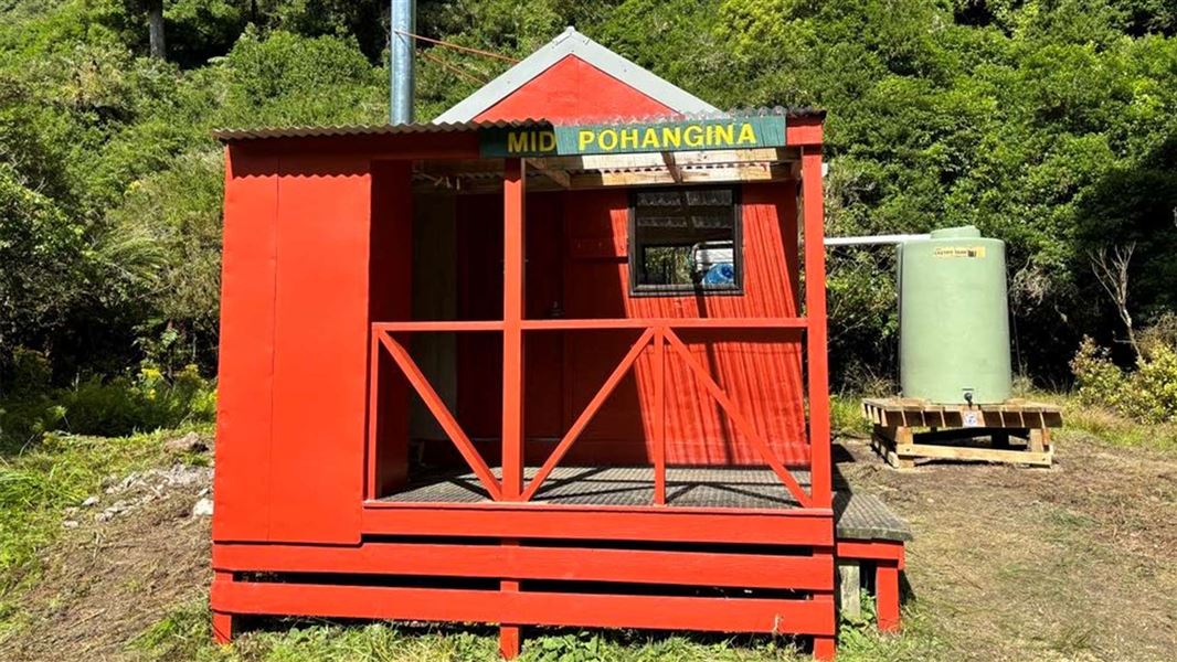
Mid Pohangina hut was renovated by PNTMC members and DOC in March 2024.
Facilities
- Water source - water tank by the hut (no feed into the hut)
- Heating source - woodburner
Fees
t
All maintenance of this hut is done by the Palmerston North Tramping and Mountaineering Club.
Donations are welcome and suggested to be a minimum of $5 a night. Alternatively DOC Hut tickets are accepted as DOC still supplies the water proof, fire proof matteresses. If you would prefer to make a bank transfer please contact the Palmerston North Tramping and Mountaineering Club through their web site.
DOC hut tickets
- Adult (18+ years): $10 per night
- Youth (5–17 years): $5 per night
- Child/Infant (0–4 years): free
Before you go, buy 1 Standard Hut Ticket (blue for adults, yellow for youth) for each night's stay. Put this in the honesty box at the hut. Or buy a Backcountry Hut Pass that gives unlimited use at most Standard and Serviced huts for a 12 month period.
About hut tickets and passes | Retailers that sell hut tickets and passes
Route to Mid Pohangaina Hut from Takapari Road
Time: 5.5 – 7.5 hours one way
Distance: 10km
Start from Takapari Road at the Ruahine Forest Park boundary. Walk up the gravel road for approximately 2 km / 30 min until you reach the DOC sign directing left to Mid Pohangina Hut. At the sign, turn left onto the Mid Pohangina Track to Takapari Road via CE Track.
Follow the Mid Pohangina Track to Takapari Road via CE track for 1.5 km / 1 hr to the junction where it meets the Mid Pohangina Hut Sidle Track. Turn right onto the Mid Pohangina Hut Sidle Track.
Follow the Mid Pohangina Hut Sidle Track for 6.5 km / 4-6 hrs until you reach Mid Pohangina Hut.
Route to Mid Pohangina Hut from Tamaki West Road
Time: 6.5 hours one way
Distance: 13 km
Park at the Tamaki West Road, Dannevirke carpark. Follow the Homes Ridge Track to Stanfield Hut. This is a 5 km walk that takes about 2 hours. It involves river travel.
From Stanfield Hut, follow the Stanfield Hut to Cattle Creek Hut Track to Cattle Creek Hut. This is a 4 km walk that takes about 2 hours. It involves one river crossing.
From Cattle Creek Hut, follow the river to Mid Pohangina Hut. This is a 4 km walk that takes about 2 hr 30 min. Note that this river access way is not via a DOC track; there is no signage or markers.
It’s dangerous to cross or follow the river when the water level is high which can occur during or after heavy rain.
Tracks to this hut
-
Duration: 3 days Difficulty: Advanced
Location
NZTopo50 map sheet: BL36
Grid/NZTM2000 coordinates: E1859098, N5561813
Takapari Road is a shared use road. Be mindful of vehicles or bikes that may be using the road.
This route crosses a number of streams. It’s dangerous to cross or follow the river when the water level is high which can occur during or after heavy rain.
Stay safe when crossing rivers
If you plan to cross unbridged rivers, know how to cross safely and be prepared for if you cannot cross.
Do not cross if the river is flooded, you cannot find safe entry and exit points or are unsure it’s safe. Turn back or wait for the river to drop. If in doubt, stay out.
DOC Customer Service Centre
| Phone: | 0800 275 362 |
| Email: | manawatu@doc.govt.nz |
| Address: | Te Papaioea / Palmerston North Office |
