Image gallery
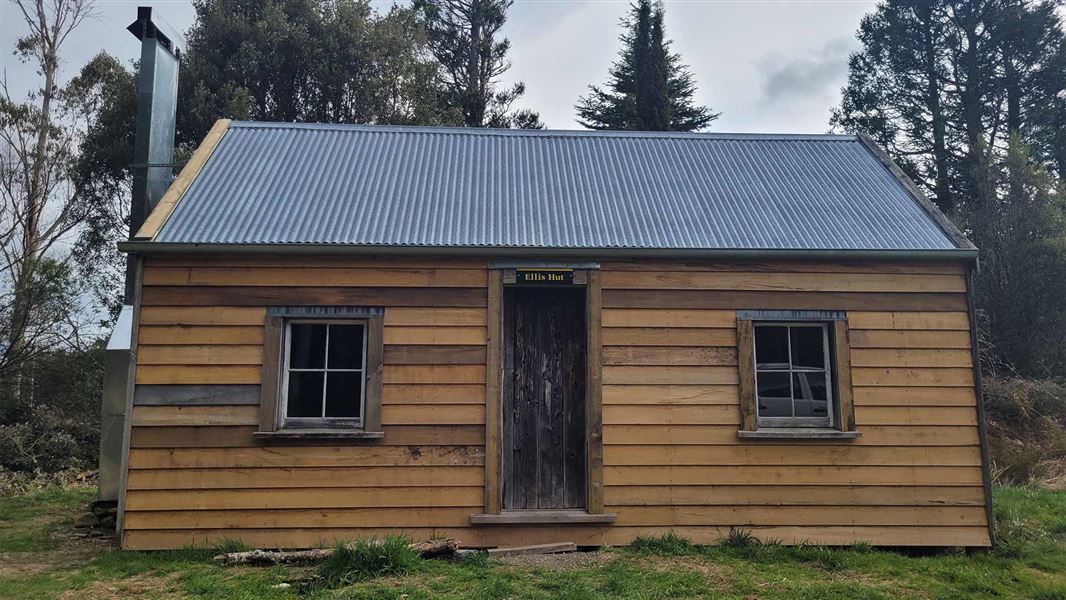
Ellis Hut is a timber frame building sheathed in pit sawn weatherboards and lined inside with hand worked beaded tongue and groove boarding. The roof is corrugated iron.
The hut is situated amidst grass and developing pine forest with regenerating native forest nearby.
Facilities
- Heating - open fire
Heritage
History
Ellis Hut was built in 1884 by Bill Marsh and Jack Curtis for Jock Anderson who owned Poporangi Station, and wanted a hut to serve the back of what was then a vast run. It was first named after Bill Whitnell, shepherd and hunter, who lived in it for many years.
In 1904 it was the temporary refuge of an infamous murderer, Jack Ellis, who had been on the run for several months and was captured at the hut. A typed copy of the story was deposited in the hut, which was subsequently named after Ellis.
The hut nearly burnt down in 1935. It was in good order in 1945 but by the 1960s it had deteriorated considerably. It was conserved in January 1995. Historical themes for this hut are farming, recreation and wild animal control
Fabric significance
Ellis Hut is a very early backcountry hut. It is an important example of a remote structure built partly in primitive fashion. The pit sawn timber is augmented by some fine hand dressed timber, unusual in such a rudimentary isolated structure.
Historic significance
Ellis Hut is the oldest surviving hut in the Ruahines and one of the oldest surviving buildings in New Zealand’s mountain regions. It had a long association with mustering in this remote area. It is most famous however for its association with James Ellis the murderer who hid at the hut for several months early in the twentieth century.
Future management
The hut will remain in use and be maintained to protect its historic fabric and minimise deterioration. Both conservation and maintenance plans (Cochran 1990) have been prepared to guide its management. They contain more information about the hut.
Fees
Free
Location
NZTopo50 map sheet: BK37
Grid/NZTM2000 coordinates: E1881401, N5598840
DOC Customer Service Centre
| Phone: | 0800 275 362 |
| Email: | manawatu@doc.govt.nz |
| Address: | Te Papaioea / Palmerston North Office |
