2.3 km from Lakes carpark to Kuripapango Road one way
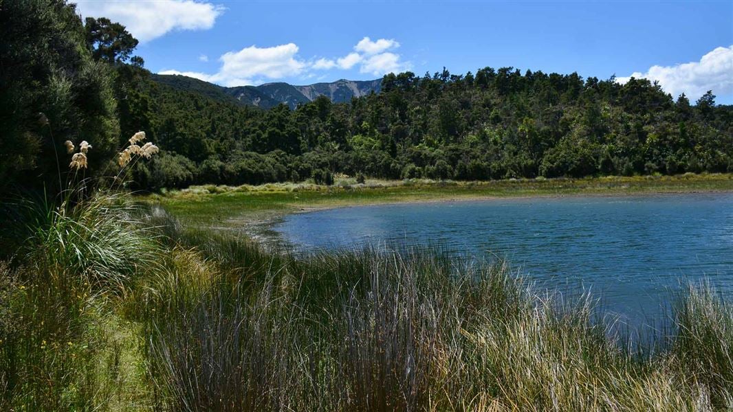
The track to Lake Rototuna and Lake Rotoroa heads left from the carpark. It passes through kanuka and hardwood forest, and after 30 minutes branches left and descends to the western lake. The lakes were formed many thousands of years ago as a result of the damming of two streams by debris from a massive slip off Mt Kuripapango. Although small, the lakes are of considerable ecological and botanical significance, for the large number of plant species and vegetation types in the immediate surrounds.
Although the level of the western lake fluctuates there is generally a sandy shoreline, where there is opportunity for picnics, fishing and walking. Visitors should take care not to damage the ecologically important flora and fauna surrounding the lakes by walking and trampling on the area.
The track continues on beyond Lake Rototuna and Lake Rotoroa to Kuripapango Road.
Kuripapango is located 76 km from Napier on the Napier/Taihape Road. To reach the Lakes carpark, turn off the Napier-Taihape Road onto Kuripapango Road and follow the signs to Lakes carpark.
Be ready for mountain weather
This is a mountainous area. Visitors should be prepared for sudden weather changes.
Check the weather before you go. Kaweka J Summit weather forecast
Fires
Extreme fire conditions can exist during summer. The park is a restricted fire area, which means permits to light fires are required all year round.
Know the rules for trout fishing
The introduced brown trout are present in the lakes and on the larger lake provide all year round fishing opportunities. Dry fly fishing is popular during the heat of the summer months as fish feed on the surface. Spinners may also be used. The smaller lake is only open for fishing from 1 October until 30 April and there is a daily bag limit of four fish. A current fishing license from Fish and Game New Zealand is required for anyone who fishes on these lakes.
The trout in these lakes are small because of the very low water temperatures and nutrient-poor water.
Maps
The Land Information New Zealand (LINZ) topographical maps that cover the Kaweka Forest Park are:
Topo50 map BH36 - Motutere
Topo50 map BH37 - Rangitaiki
Topo50 map BH38 - Te Haroto
Topo50 map BJ36 - Tawake Tohunga
Topo50 map BJ37 - Kuripapango
Topo50 map BJ38 - Te Pohue
Topo50 map BK37 - Tikokino
Although small (about 5 and 8 hectares), Lake Rototuna and Lake Rotoroa and their surrounds host over 280 native plan species, including several that are uncommon and nationally significant.
Lake Rototuna and Lake Rotoroa, sometimes called Twin Lakes, were formed many thousands of years ago after a massive slip from the slopes of Kuripapango filled the valley and blocked the path of two minor streams. Only the western lake as an outflow – a small underground stream emerging some 500 m to the south. It has a fluctuating water level, whereas the east lake is relatively stable. However, the eastern lake may periodically overflow into the slightly lower western lake.
Fishing: All gear should be cleaned properly before and after trips to help stop the spread of aquatic pests such as didymo.
DOC Customer Service Centre
| Phone: | 0800 275 362 |
| Email: | napier@doc.govt.nz |
| Address: | Ahuriri / Napier Office |
