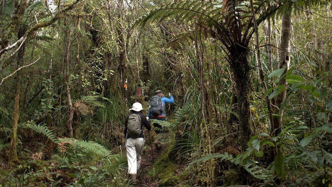
Karaka Track is a rugged and overgrown tramping track. There are boggy sections and stream crossings that can be difficult. For an easier option, try Waiotahi Track: this is a well-formed track with good all-weather access.
Karaka Track starts from Karaka Road, Thames and follows Karaka Stream all the way up the valley. You will need to cross Karaka Stream without a bridge. This is fine at low flows, but the stream is not safe to cross when the water levels are high (especially after heavy rain). Assess it carefully before crossing and if in doubt, stay out.
The track climbs to the ridge at the top of the valley. There are great views from ‘Red Rocks’ looking towards Table Mountain. The track follows the ridge, where it soon connects with Waiotahi Track. This junction is around 2 hours 30 min from the track entrance.
There is mountain biking access from Karaka Road until the Red Rocks area. There is then a stile and fence, and only walking access beyond it.
For a day walk loop
You can take a circuit back to Karaka Road, by going left at the junction, following Waiotahi Track to Waiotahi Road, then walking 30min by road back to Karaka Road.
To Crosbies Hut
To continue to Crosbies Hut, continue straight ahead along the ridgeline at the track junction.
Follow Karaka Track along the forested ridge. You pass another track junction, where Tararu Track meets Karaka Track. Continue straight ahead along the ridge.
There is another track junction, where Whangaiterenga Track meets Karaka Track. Continue on Karaka Track along the ridge. The track skirts to the left of a high point (646m). Not far beyond this, a short side track leads to Crosbies Hut.
The track starts from Karaka Road, Thames.
This is a tramping track, make sure it’s right for you
This is a backcountry tramping track: it is rough, overgrown and boggy in places. There are unbridged stream crossings that can be dangerous after heavy rain.
It is best suited to experienced trampers who are comfortable on rough tracks and have good river crossing skills.
Waiotahi Track is an alternative – this is a well-formed track with good all-weather access.
Wear sturdy shoes with good grip, as the clay soils are slippery. It can be very muddy especially after rain.
Take care when crossing Karaka Stream
This stream can be dangerous to cross when the stream levels are high (e.g. after heavy rain). Assess it carefully before crossing and only cross if you are sure it’s safe.
Learn more about how to cross rivers safely (including the signs of an unsafe river)
Do not enter historic mining tunnels
There are historic mining tunnels in the Karaka Stream valley. These are closed to the public as they are unstable. For your safety, do not enter them.
Stay safe in the outdoors
- Choose the right trip for you. Learn about the route and make sure you have the skills for it.
- Understand the weather. Check weather forecasts.
- Pack warm clothes and extra food. Check gear lists.
- Share your plans and take ways to get help. Leave your intentions with a trusted contact and take a distress beacon.
- Take care of yourself and each other.
Kauaeranga Visitor Centre
| Phone: | +64 7 867 9080 |
| Email: | kauaerangavc@doc.govt.nz |
| Address: | 995C Kauaeranga Valley Road Thames 3577 |
| Hours: | Visitor centre hours and services |
