Image gallery
Waipakihi Valley is accessible from the Waipakihi Road end and provides relatively easy walking and excellent hunting. There are many good campsites along the river.
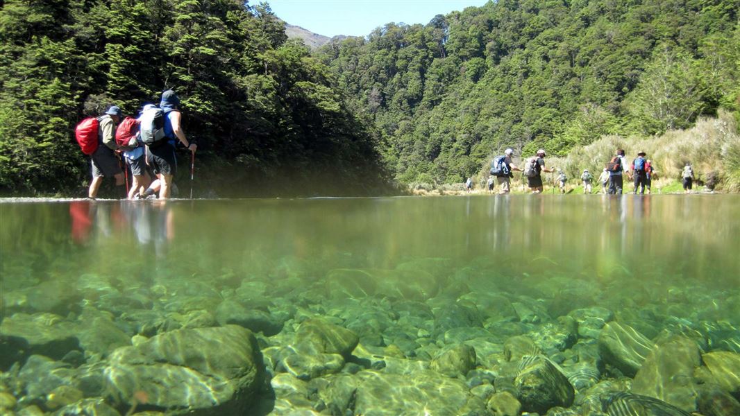
There is no defined track in the valley and you should be prepared for frequent river crossings. You need good river crossing skills, including being able to judge when the river is safe to cross, what the best crossing point is, and how to cross safely.
River levels can rise quickly during and after heavy rain – it may be dangerous in high flow. Assess the river carefully and don’t attempt this trip if you aren’t confident that it’s safe.
Waipakihi normal flow is 8-10 cumecs, high is 13 and over. For the latest updates, see Tongariro flow, level and rain data or phone +64 7 386 8113 (or free phone 0800 435 697 (0800 4 FLOWS)).
The southern bank of the Waipakihi River, from the Waipakihi Gorge to Waikato Stream and extending south to the ‘Needles Block’, is private land. Contact Danny Loughlin, Kaiamanwa 3B2A, 3B2B Trust, phone +64 7 376 0092 or email danny@blackburnegroup.co.nz.
Waipakihi Road is 38 km south of Tūrangi, off SH1.
You can also reach Waipakihi Valley via the Urchin Track.
Take care when crossing Waipakihi River
It is not safe to tramp up the Waipakihi riverbed in all conditions – it will be dangerous if the river is high (for example, during/following heavy rain). Assess the river carefully and don’t attempt this trip if you aren’t confident that it’s safe.
Have a back-up plan for if this route is not possible and carry an emergency shelter and extra food, in case you are delayed by a rising river.
Genesis Energy monitors flows in the Waipakihi River, see Tongariro flow, level and rain data or phone +64 7 386 8113 (or free phone 0800 435 697 (0800 4 FLOWS)).
Be prepared for cold, wet weather at any time of year
The weather in Kaimanawa Forest Park is extremely changeable. Visitors should be prepared for cold wet conditions even in summer. Frosts and snow are likely on high ground throughout the year.
The annual rainfall is approximately 3500 mm and decreases towards the east.
Always carry warm and waterproof clothing. Check weather forecast
Pack for a remote, backcountry area
The Kaimanawa Forest Park is a remote area and you can expect rough, tramping tracks. It is best suited to experienced trampers with river crossing, navigation and backcountry skills.
Pack to be self-sufficient by packing everything on this tramping packing list.
There is no cell phone coverage in many parts of the park. Always carry a distress beacon.
Check the fire danger
During periods of extreme fire danger the lighting of fires in the open may be prohibited. Check the fire danger on checkitsalright.nz
Even when fires are allowed, we recommend using portable stoves rather than lighting open fires. If you must use a wood fire, obtain firewood from dead trees only.
Stay safe in the outdoors
- Choose the right trip for you. Learn about the route and make sure you have the skills for it.
- Understand the weather. Check weather forecasts.
- Pack warm clothes and extra food. Check gear lists.
- Share your plans and take ways to get help. Share directly or use the Outdoor Intentions form or Plan My Walk. Take a distress beacon.
- Take care of yourself and each other.
DOC Customer Service Centre
| Phone: | 0800 275 362 |
| Email: | turangi@doc.govt.nz |
| Address: | Tūrangi Office |
