SH8 runs directly through the township of Tekapo on the shores of the lake, about 3 hours drive from Christchurch. Daily shuttle services operate between Christchurch, Lake Tekapo and Queenstown.
What to take
Light footwear, such as running shoes is adequate for most walks. For longer walks, sturdy boots are more suitable. Take a warm jersey or jacket, as the weather can change quickly in the mountains and even on sunny days the wind can be cold.
Ultraviolet rays can be very intense in the Mackenzie Basin, so a sunhat and 15+ sunblock are essential on fine days.
Consider taking something to eat and drink, and don’t forget your camera.
Geology
About 259 to 300 million years ago, the Mackenzie Basin was part of a seabed trough estimated by geologists as hundreds of kilometres long and possibly 160 km wide. However, the present-day Mackenzie is the result of the so-called ‘ice age’. The oldest evidence suggests there were numerous advances and retreats between 120,000 and 200,000 years ago.
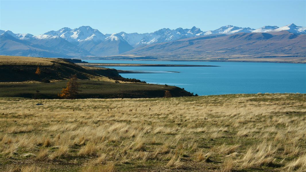
Four main advances are clearly identified by the glacial moraines they left behind. Lake Tekapo lies behind the moraines of the Tekapo ice advance of 12,000–14,000 years ago, and occupies the valley left by the retreating ice. The lake is 30 km long and 120 m deep. The refraction of light through finely ground rock particles of the glacial melt waters that feed the lake is the reason for its remarkable turquoise colour.
The dominant feature is Mt John, a ‘roche moutonée’ (glacial abraided rock mass) formed by overriding of the ice during an earlier advance. West of Mt John is Lake Alexandrina, also impounded behind the moraines of the Tekapo ice advance.
Wildlife
The shallow waters of the bays around the lake edge often provide a haven for black swan, scaup, pied stilt and, sometimes, even the rare crested grebe and black stilt.
In the grasslands around the lake, Himalayan chukor, introduced to new Zealand as a game bird, are often seen on the higher areas. Look out too for long and short tussock skinks and possibly geckos, although because they are nocturnal, these reptiles prefer to seek refuge in rocks and tussock during the day.
The Mackenzie Country
The first people to enter the Mackenzie Basin were Māori. They quarried stone for tools, fished for eel, hunted birds, including moa, and established summer camps along the rivers and lakes. Māori names were given to the inland lakes – Tekapo, Te Kaupururu (Alexandrina), Otetoto (MacGregor), Pukaki, Ohau. The name Tekapo derives from the Māori words Taka (sleeping mat) and Po (night).
Māori told white settlers of the grassy plains of the interior, but the Mackenzie Basin really only became known in 1855 when James Mckenzie, a Scottish shepherd was arrested for sheep stealing. Seeking a less conspicuous route for his flock, he ventured inland and discovered the high country that now bears his name.
John Sidebottom, the man responsible for McKenzie’s arrest, lodged the first lease application in the basin but failed to take up the 30,000 ha within the six-month requirement. The lease was cancelled and the land was divided up among other runholders. Within ten years the whole of the Mackenzie Basin, totalling 704,000 ha, was taken up.
In 1857 John and Barbara Hay established Tekapo Station, the first sheep farm in the Mackenzie, on the shores of Lake Tekapo. When the lake is low, remains of the homestead can be seen on the walk to Pines Beach. An accommodation house was established in 1861, along with a ferry across the Tekapo River. Popular as ‘bullocky’ resting place, it became well known throughout the district. In 1881 the foundations of the first bridge were laid. When the Mount Cook-Hermitage Company formed it ran a coach between Fairlie and the Hermitage, stopping for lunch at Lake Tekapo.
Hydo power
When the hydro power project began in the 1930s, Tekapo township stated to grow. In 1935 the foundation stone was laid for the Church of the Good Shepherd, and the building was completed later that year.
The construction of the Tekapo Power Station was delayed owing to the Second World War, but it was eventually commissioned in 1951. When the lake level rose, the bridge was demolished an a new hotel built on its present location. The main road now crosses the Tekapo River over the dam-control gates.
Mt John Observatory
On Mt John, a hill rising 300 m above Lake Tekapo, is the University of Canterbury Observatory. Following site surveys in early 1960s, Mt John was selected as the best site in New Zealand because it has high number of clear nights, is remote from bright lights, the air is transparent and steady, and it is close to roading and electricity.
The Observatory is operated by the Physics Department of the University, astronomers from the Observatory and research laboratories in Australia, North America, Asia and Europe, who use the facilities for astronomy and astrophysics scientific investigations. Until the end of 1983, the Observatory shared the hilltop with a satellite-tracking station.
Check, Clean, Dry
Clean all gear when moving between waterways to prevent the spread of didymo and other freshwater pests.
Aoraki/Mount Cook National Park Visitor Centre
| Phone: | +64 3 435 1186 |
| Email: | mtcookvc@doc.govt.nz |
| Address: | 1 Larch Grove Aoraki/Mount Cook 7999 |
| Hours: | Visitor centre hours and services |
