This trip is suitable for well-equipped people with previous backcountry tramping experience. Make sure you understand what you need to Know before you go.
From the eastern side, the route starts near Greyneys Shelter on SH73. It follows the Mingha River, crosses the Main Divide at Goat Pass, then follows the Deception River to come out at Morrisons footbridge on SH73, near Aickens corner.
Note: True left and true right refer to the side of the valley or river when facing and looking downstream.
Greyneys Shelter (SH73) – Mingha River – Goat Pass Hut
Time: 5 hr
5 km south of Arthur’s Pass village, cross Bealey River after it meets the Mingha River. The rivers are constantly changing course so you will need to find the best place to cross. If Bealey River is too high to ford, postpone the trip. Do not use the Bealey rail bridge to get to the Mingha.
Once across Bealey River go up the Mingha riverbed, crossing the river as necessary for about 1 hour until the river narrows to a gorge. Just past a side creek on the true right, a marked track enters the bush on that (western) side. The track climbs well above the gorge on to Dudley Knob, and then makes its way back to the river close to the bush line.
Shortly after the track emerges from the bush there is small hut, Mingha Bivvy.
Warning: Mingha Bivvy is located in known avalanche paths. Avalanches are most likely to occur during and following heavy snowfall or rain when snow loading is present on the upper mountain slopes. Do not use this hut during these high-risk periods. Check Arthur's Pass avalanche forecast
From here follow the marked trail, crossing Mingha River where it bends west towards Temple Col and is met by the stream running down from Goat Pass.
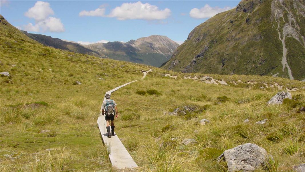
The marked track resumes here through subalpine scrub on the true left of Goat Pass Stream, leading onto boardwalk across the boggy sections. The track continues across sections of boardwalk through to the obvious summit of Goat Pass. Goat Pass Hut is in a hollow just north of the pass.
Goat Pass Hut has a radio linked to Arthur’s Pass Visitor Centre. Calls can be made during office hours for weather forecasts and information.
Side trip: Lake Mavis
Time: 2 hr
For parties in the summer with time in hand at Goat Pass, the 500 m climb to Lake Mavis is worthwhile. Climb the steep tussock and scree on the spur running east from Goat Pass, then follow the cairned ridge route – perhaps the easiest access to a high level lake in the park.
This area is subject to avalanche activity during the winter. During heavy snow conditions, we advise visitors not to travel this route unless sufficiently equipped, and experienced enough to assess the conditions and choose a safe path through avalanche terrain.
Goat Pass Hut – Deception River – Morrisons footbridge (SH73, Aickens corner)
Time: 8–9 hr
Warning: The western part of this route involves a lot of riverbed travel; route times are highly changeable depending on the state of the river crossings.
Follow the marked route down a creek bed through scrub into the upper Deception River. The route now involves scrambling and boulder-hopping down the riverbed and through adjacent bush (sometimes on distinct bits of track which may be marked). Upper Deception Hut is reached in just over an hour, before Good Luck Creek on the true right bank. It is very easy to miss this hut on its scrub-covered river terrace.
Continue on or beside the riverbed for a further 2 hours 30 minutes until it opens out into a large flat on the true left, just below Gorge Creek. Below this flat the river passes a small, warm, sulphur-smelling spring then narrows to the gates of the lower gorge. Continue on down the lower gorge for 2 hours or more to the open flat where the Deception meets Otira River.
The footbridge across the Otira is just north of the confluence (on the true right bank of the Deception).
Getting there
Greyneys Shelter is 5 km south of Arthur’s Pass village, on SH73. There is some parking available off SH73, but vehicles have been broken into.
There are also two shuttle bus services between Christchurch and Greymouth. Atomic Shuttles runs from Christchurch to Greymouth and back each day, while West Coast Shuttles does a return trip between Greymouth and Christchurch every day.
This trip is suitable for well-equipped people with previous backcountry tramping experience. Make sure you understand what you need to Know before you go.
From the western side, the route starts at Morrisons footbridge on SH73, near Aickens corner. It follows the Deception River, crosses the Main Divide at Goat Pass, then follows the Mingha River to come out at SH73 by Greyneys Shelter.
Note: True left and true right refer to the side of the valley or river when facing and looking downstream.
Morrisons footbridge (SH73, Aickens corner) – Deception River – Goat Pass Hut
Time: 8–9 hr
Note: The western part of this route involves a lot of riverbed travel; route times are highly changeable depending on the current state of the river crossings.
From SH73 Morrisons footbridge crosses the Otira River. Follow the marked route through river flats on the true right of the Deception River until the river narrows and turns into a gorge. From here cross to the true left and continue upstream. The route further up Deception valley crosses the river numerous times with travel primarily being in the river bed, although there are some tracked sections.
After travelling upstream for about 11 km, a prominent creek (Dorreen Creek) joins the Deception River on the true left. A marked track begins here on the true right of Dorreen Creek. A further kilometre on from Dorreen Creek the track re-emerges beside the river. Cross here and be sure to spot the orange marker on the other side indicating the location of the Upper Deception Hut.
From the Upper Deception Hut the route involves scrambling and boulder-hopping up the riverbed and through adjacent bush (sometimes on distinct sections of track that may be marked) for around 1 hour, before a final crossing of the Deception River (onto the true left). At this point you leave the Deception River to scramble up a steep side stream for about 500 m to reach Goat Pass Hut.
The hut has a radio linked to Arthur’s Pass Visitor Centre. Calls can be made during office hours, 7 days a week, for weather forecasts and information. Goat Pass can be extremely cold and dramatically different from the lower sections of the route.
Side trip: Lake Mavis
Time: 2 hr
For parties in the summer with time in hand at Goat Pass, the 500 m climb to Lake Mavis is worthwhile. Climb the steep tussock and scree on the spur running east from Goat Pass, then follow the cairned ridge route – perhaps the easiest access to a high-level lake in the park.
This area is subject to avalanche activity during the winter. During heavy snow conditions, we advise visitors not to travel this route unless sufficiently equipped, and experienced enough to assess the conditions and choose a safe path through avalanche terrain.
Goat Pass Hut – Mingha River – Greyneys Shelter (SH73)
Time: 5 hr
From the hut the track passes through subalpine scrub whilst crossing over Goat Pass (1,070 m) before descending to the headwaters of the Mingha River. Once this is crossed, follow the marked track on the true right of the river to reach Mingha Bivvy.
Warning: Mingha Bivvy is located in known avalanche paths. Avalanches are most likely to occur during and following heavy snowfall or rain when snow loading is present on the upper mountain slopes. Do not use this hut during these high-risk periods. Check Arthur's Pass avalanche forecast
For the next 3 km the track undulates through bush before it steepens for a short section to reach Dudley Knob. The track passes through bush for another 1 km, sidling high above the Mingha Gorge before emerging onto the expansive flats of the lower Mingha River.
Continue heading downstream for 3.5 km, aiming for the power poles and the Bealey River in the distance and crossing the Mingha River where necessary. Once the Bealey River is reached, cross it above its meeting with the Mingha River. The rivers are constantly changing course so you will need to find the best place to cross.
Once the Bealey River is crossed, take care crossing the railway tracks to reach SH73. Greyneys Shelter campsite is a further 500 m south.
Those running the Coast to Coast need to continue along the Bealey riverbed for a further 2–3 km to come out at Klondyke Corner.
Getting there
Morrisons footbridge is 5 km west of the Otira township on SH73. Car parking options are limited and we advise not leaving vehicles on the roadside longer than one day. There are better car parking options at the eastern end of the route.
There are also shuttle bus services between Christchurch and Greymouth
Experience: Suitable for well-equipped people with previous backcountry tramping experience. River crossing skills essential.
River crossings: Both the Deception and Mingha rivers can be dangerous. Do not attempt this trip when these rivers are high or when bad weather is forecast. Travel along the Deception River requires up to 30 compulsory river crossings. Rivers can flood at any time of year. If rivers and side streams are in flood, seek shelter and wait until water levels fall before crossing.
Best season: Summer, autumn and early winter.
Required maps: NZTopo50: Otira BV20.
Hazards: Flooded rivers, avalanches, steep drop-offs and bluffs.
Safety: This route guide must be read in conjunction with Tramping in Arthur's Pass National Park (PDF, 762K), and New Zealand's Land Safety Code.
Before setting out, check the latest track conditions and avalanche advisory with the Arthur's Pass Visitor Centre.
Stay safe when crossing rivers
If you plan to cross unbridged rivers, know how to cross safely and be prepared for if you cannot cross.
Do not cross if the river is flooded, you cannot find safe entry and exit points or are unsure it’s safe. Turn back or wait for the river to drop. If in doubt, stay out.
Thieves targeting cars at Arthur's Pass
There have been reports of cars being broken into and disabled at track ends.
- Don't leave valuables in your vehicle.
- Consider using more public parking sites – ask at the Arthur's Pass Visitor Centre for alternative options.
- Report any suspicious activity to police on +64 3 363 7400.
There may be avalanche danger
Avalanches usually occur from May to November in Arthur’s Pass National Park. There can also be avalanches outside this period, if there is still snow coverage.
Check the avalanche terrain in this area.
If you are going into avalanche terrain, always:
- Have the relevant avalanche skills and training.
- Check the ATES rating and New Zealand Avalanche Advisory before you go.
- Go with a buddy. Both of you should carry and know how to use an avalanche transceiver, a snow shovel and a probe.
Stay safe in the outdoors
- Choose the right trip for you. Learn about the route and make sure you have the skills for it.
- Understand the weather. Check weather forecasts.
- Pack warm clothes and extra food. Check gear lists.
- Share your plans and take ways to get help. Share directly or use the Outdoor Intentions form or Plan My Walk. Take a distress beacon.
- Take care of yourself and each other.
Check, Clean, Dry
Clean all gear when moving between waterways to prevent the spread of didymo and other freshwater pests.
Arthur's Pass National Park Visitor Centre | |
---|---|
Phone | +64 3 318 9211 |
arthurspassvc@doc.govt.nz | |
Address | 104 West Coast Road Arthur's Pass 7654 |
Hours | Visitor centre hours and services |