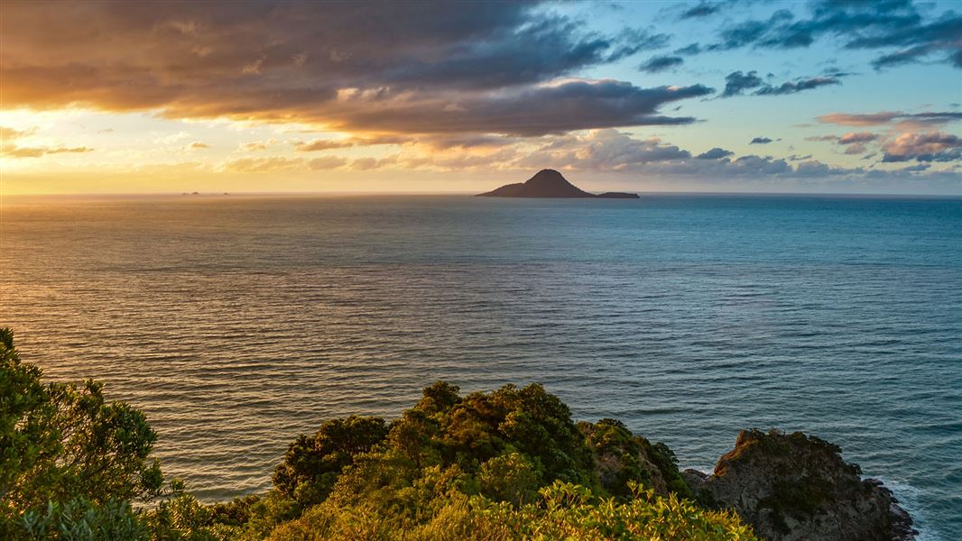
It includes pā sites of major historical significance, superb native forest with spectacular pōhutukawa stands, unsurpassed coastal views, beaches, an abundance of birdlife and a well-formed track.
Ngā Tapuwae o Toi (The footsteps of Toi) is aptly named as it traverses the heart of what was once the great chieftain Toi’s dominion. His stronghold, Kapu-te-Rangi (Pā of Gentle Breezes), is one of the oldest known pā sites in the country and is a highlight of the Kōhī Point portion of the walkway.
It has an incredible panoramic view of the volcanic peaks of Whakaari/White Island through to Mount Tarawera.
We look after Ngā Tapuwae o Toi Walkway with Whakatāne District Council (WDC).
Check for closures, more information and get maps on their website.
We look after Ngā Tapuwae o Toi Walkway with Whakatāne District Council (WDC).
Check for closures, more information and get maps on their website.
Mokorua Gorge to Toi Pā
Time: 1 hr 30 min
Easy walking. This is the best starting point for the round trip. Walkers should head north from Mokorua Gorge along Commerce Street, turning right just before Pohatoroa (the Rock) to climb the escarpment steps leading to Hillcrest Road. Turn left onto Seaview Road to find the track leading to Kapu-te-rangi.
Soon after leaving the road, the track passes the head of Wairere Falls. After climbing through an area of attractive regenerating bush, Kapu-te-rangi is on the right. From this pā, continue north-east, the track follows the cliff top above Whakatāne, skirting a number of pā sites. Toward the tip of Kohi Point, the track emerges onto an area of low scrub and flax land and then follows the cliff tops to the south-east. Superb coastal vies are obtained throughout this section, but for your safety please stay to the track.
Toi Pā to Ōhope Beach West End
Time: 2 hr
Easy walking. After rounding a headland, several tiered staircases lead down to Otarawairere Bay, a great place for a picnic, swim or a bit of fishing. Note: Otarawairere Bay is not accessible during high tide - check Whakatāne high tides on the Metservice website.
Access to the bay is also available via a track down from Otaraweairere Road. To continue on the walk, pass this track and rejoin the walkway near the eastern end of the bay to cross the headland to Ōhope Beach.
Ōhope Beach West End to Ōhope Scenic Reserve
Time: 30 min
Easy walking. Walk along the beach to the bottom of hope Hill and West End Road intersection. Cross the road to Ōhope Scenic Reserve.
Fairbrother Loop Walk
Time: 1 hr
Easy walking. Soon after leaving Ōhope Beach, is the foundation of an old pumping station. Take the left fork for a pleasant uphill walk featuring a number of views over the forest and Ōhope Beach. At the intersection at the top of the loop carry straight on to finish the loop back at to where you started at the bottom of Ōhope Hill. Take the turn-off if you want to carry on with the Nga Tapuwae o Toi round trip.
Ōhope Scenic Reserve to Burma Road
Time: 1 hr
Easy walking. Take the same track as the Fairbrother Loop described above except at the top of the hill take the turn-off sign posted as Burma Road. This track pleasantly sidles along the side of a ridge and comes out at Burma Road.
Burma Road to White Horse Junction
Time: 45 min
Moderate walking. After crossing Burma Road, the track climbs steeply before entering private land. Here, sections of raised boardwalk make for an easy and charming walk through areas of native forest and wetland featuring large pukatea, tawa and puriri trees. Further on, the track meets the Mokorua Reserve walkway at the White Horse Drive Junction.
White Horse Junction to Mokorua Gorge
Time: 45 min
Some steep sections. The walkway traverses the stream valley a number of times before climbing the high ridge overlooking Whakatāne. It then follows the ridge down to a final steep descent to the walkway exit adjacent to the car park at the bottom of the gorge. This last section is locally known as the 'Bird Walk'.
The best starting point for the Ngā Tapuwae o Toi Walkway is the Whakatāne end of the Mokorua Gorge, on the Pacific Coast Highway.
Get more information on getting there and a map on the Whakatāne District Council website.
DOC Customer Service Centre
| Phone: | 0800 275 362 |
| Email: | easternbop@doc.govt.nz |
| Address: | Whakatāne Office |
