For tide, boundaries and other information you can download the MarineMate app.
The reserve is bounded to the south by the industrial suburb of Rosebank Peninsula and to the east by residential Waterview.
There is access to the inner parts of the reserve around Traherne Island on the southern side of the motorway.
This area can be explored at mid-high tide or from a few shoreline points (arrowed on the map) where side roads from Great North Road lead to esplanade reserves, with dinghy access at Walker Rd.
There are good views from the Northwestern Motorway (Te Atatu exit). Stopping on the motorway is not permitted.
Do not take or kill fish, crustaceans (eg crabs, shrimps, prawns), shellfish (eg snails, mussels, oysters, and clams such as cockles and pipis), seaweed, shells or rocks from the beach, or any other marine life within the marine reserve.
Boats, including jet skis, must not exceed five knots within 200 m of land (including shell banks) within the marine reserve area.
Dogs are not allowed in the marine reserve area because they endanger rare birds.
Contaminants being discharged into the reserve at the time of its implementation, meeting all legal requirements may continue if there is continued compliance with any other legal requirements.
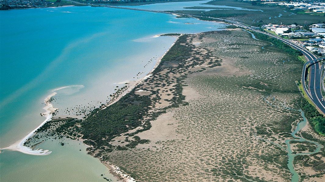
Mōtū Manawa-Pollen Island Marine Reserve includes intertidal mudflats, tidal channels, mangrove swamp, saltmarsh and shellbanks. Learn about habitats in Mōtū Manawa-Pollen Island Marine Reserve.
The Waitemata Harbour’s sheltered and bountiful waters attracted early Maori settlement. The head of the Whau inlet was a main canoe portage joining the Waitemata and Manukau harbours.
Motumānawa / Pollen Island was named after Dr Daniel Pollen who bought it in 1855 together with some land at the tip of the Whau Peninsula. There he set up Pollen Brickworks, the first in the region, and built his homestead nearby. Pollen had been a doctor on Kawau Island during its mining period and was Premier of New Zealand for a few months in 1875/76.
The rectangular concrete structure visible at the northwestern end of Motumānawa/Pollen Island is thought to have been associated with shell extraction and processing for the production of lime. The structure is believed to be the remains of a tidal sea water pool for washing shell that was then transported to the mainland.
The remains of a tramway used for transporting shell, which connected the old cart road running to the end of the Rosebank Peninsula and the outer shell bank of Motumānawa/Pollen Island, can be seen as a faint line running across the centre of the photo above. The tramway was built up across the mudflats using a two inch layer of tea tree topped by a three inch layer of shell. Wooden box culverts were constructed across several small tidal channels.
Protect our marine reserves
- No fishing of any kind.
- Don't take or kill marine life.
- Don't remove or disturb any marine life or materials.
- Don't feed fish - it disturbs their natural behaviour.
- Take care when anchoring to avoid damaging the sea floor.
Auckland information | |
Phone: | +64 7 867 9080 |
Email: | kauaerangavc@doc.govt.nz |
About: | Kauaeranga Visitor Centre provides visitor information for this area |