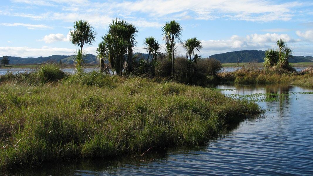
Whangamarino wetland is an extensive mosaic of swamps, fens, bogs and open water around the Whangamarino and Maramarua Rivers.
Covering almost 7,000 ha in Waikato, Whangamarino is the second largest freshwater wetland in the North Island and was chosen as one of three nationally significant wetland sites in DOC's Arawai Kākāriki wetlands restoration programme.
Whangamarino has major recreational, historical and economic values, and has been designated an international Ramsar site in recognition of its status as an area of outstanding biodiversity.
Image gallery
Ecosystems
A rich variety of freshwater ecosystems are represented in Whangamarino, combining peatland (bogs), marshes, fens and swamps with rivers and open water. The diverse wetland habitats are home to a wide range of native birds, fish and plants, many of which are rare and threatened. Large areas of highly threatened fen and bog provide habitats for unique communities of plant species which have adapted to the low-nutrient, high acidity environment.
The wetlands provide a raft of ecosystem services, such as cleaning and filtering water, trapping sediment, replenishing groundwater, providing both flood and drought mitigation, and sequestering carbon. Years of land use, increased flooding, and the onset of introduced species have dramatically changed the wetland, diminishing the health of the ecosystems and its ability to continue providing these services.
Flora
Manuka, wire rush and varieties of Machaerina sedge dominate the peatland vegetation, while the marshes and swamps support a wide range of indigenous and exotic plants. Whangamarino is rich in lichens and mosses, with 13 new moss species added to the list of New Zealand flora from this area alone.
The at-risk spiranthes orchid (commonly known as ladies' tresses) grows alongside other threatened plants like the water milfoil and club moss. Whangamarino is the only site in the world where the critically endangered swamp helmet orchid (Corybas carsei) is found.
Exotic species like willow, alligator weed and yellow flag iris are prolific in the wetlands and compete with native species.
Fauna
Whangamarino wetland is an important habitat for threatened bird species such as grey teal, spotless crake, white heron, weweia (dabchick) and the North Island fernbird. It's also a stronghold for the Australasian bittern/matuku-hūrepo, with 20% of New Zealand's breeding population residing in the wetland.
Eighteen species of native fish have been recorded in the wetlands, including threatened species like inanga (whitebait) and tuna (longfin eel). The black mudfish, a rare species which survives over the dry summer months by burrowing into mud or under damp tree roots, is found only in the Auckland-Waikato area.
Invasive fish species are a problem in the wetland, especially catfish and koi carp. Their aggressive feeding behaviour stirs up bottom sediment, which affects bank stabilisation and aquatic life.
History and culture
Waikato-Tainui iwi consider Whangamarino a taonga (treasure) and have a long association with the area. Early Māori sourced food like birds and tuna (eel), and used harakeke (flax) for cultural purposes. Peat margins were used to preserve taonga such as waka, tools, and weapons. The rivers provided a means of transport and recreation, and the dense vegetation of the wetlands offered a place of sanctuary in times of war.
Whangamarino was the site of major battles in the Waikato War of 1863-64. The Whangamarino Historic Walk passes two key sites of conflict, Whangamarino Redoubt and Te Teoteo's Pa, and looks out over the Meremere Redoubt, one of 22 earthwork forts built between Auckland and Pirongia.
Water levels dropped considerably when the Lower Waikato-Waipa Flood Protection Scheme was instigated during the 1960s. The hydrology of the wetland has also been affected by sand extraction and hydro-power generation on the Waikato River.
In 1994 DOC and Fish & Game commissioned the construction of a rock rubble weir (a low dam) on the Whangamarino River to restore water levels. The weir maintains wetland inundation over 2,000 ha of the swamp.
