This route is suitable for well-equipped and experienced backcountry trampers and climbers only. The best seasons to go are summer and autumn.
The track crosses numerous small creeks and the main Moeraki River. These flood quickly during rainfall. Do not attempt to cross flooded rivers and side streams – wait until river levels have dropped before proceeding.
SH6 to Horseshoe Flat Hut tramping track
Time: 4 hr 30 min
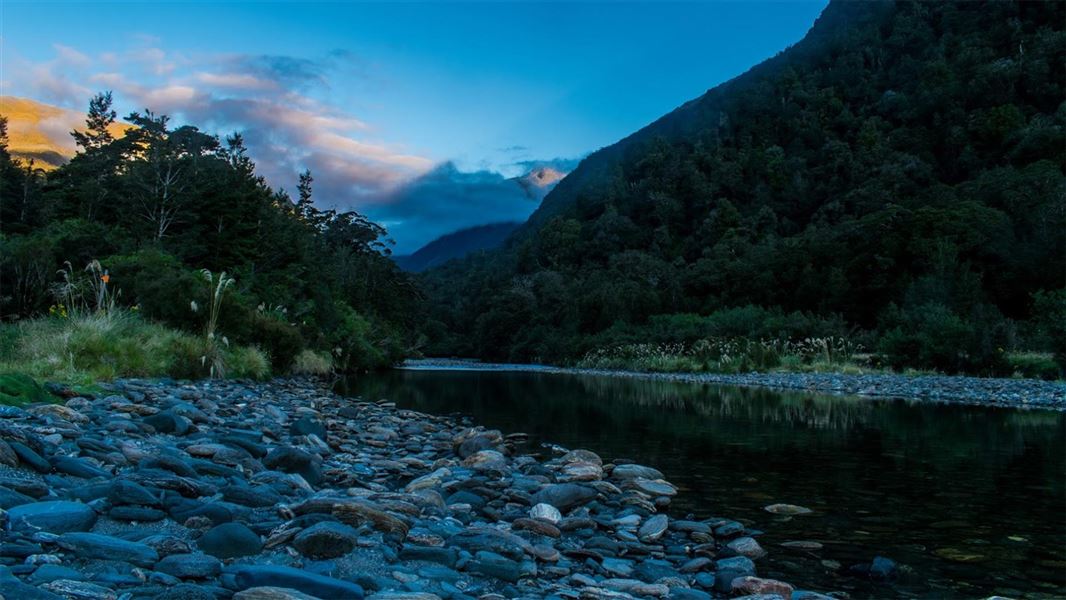
The track up the Moeraki valley initially follows the Haast – Paringa Cattle Track. The first section of track detours from the original Cattle Track to avoid the lowland swampy landscape around Windbag Creek, but soon picks up the original track line. The flat, well-benched track then follows the Moeraki (Blue) River to the Moeraki Valley Track junction, just before the swingbridge to Blowfly (Blue River) Hut. Turn left at the junction, following the sign for Horseshoe Flat Hut.
The track meanders through mixed beech and podocarp forest on the true right of the river. The track then follows a branch of the Moeraki River before emerging onto the first of a series of swampy clearings with groves of ribbonwood and scrub. Be careful to follow the track markers through this area.
In general the track leads along the base of the hill and doesn’t follow the meandering course of the river. However, at one point where the track has been eroded, it is necessary to follow the riverbank until markers are found again. Shortly before the hut, the track comes out onto the gravel riverbed. Horseshoe Flat Hut will soon come into view on a grassy flat.
Horseshoe Flat Hut to Middle Head Hut route
Time: 2 hr
Follow the markers through the bush until the route emerges onto grassy flats. Follow the flats upstream until a suitable crossing of the river can be found.
The river will be impassable during and after moderate to heavy rainfall. Do not attempt to cross in these conditions or if rain is forecast while you are further up the valley, as you will be unable to return to Horseshoe Flat Hut.
If it is safe to do so, cross the river and continue upstream over the gravel flats until markers indicate the beginning of the route through the bush again. From here the route climbs through open beech forest.
There is a short section of scrub before a crossing of a creek flowing from Zelian Saddle. Middle Head Hut is located near the confluence of this creek and the Middle Head branch of the Moeraki River.
Middle Head Hut to Middle Head Basin route
Time: 2 hr
The side-trip into Middle Head Basin from the hut is worthwhile. The route continues from just above the hut and descends to the Moeraki River.
Cross the river (impassable during and after rain) to the true right and follow a marked route uphill through beech forest. Continuing past a rock biv, the route eventually drops down and emerges into the scrub and finally tussock of Middle Head Basin. The route ends here.