Image: DOC
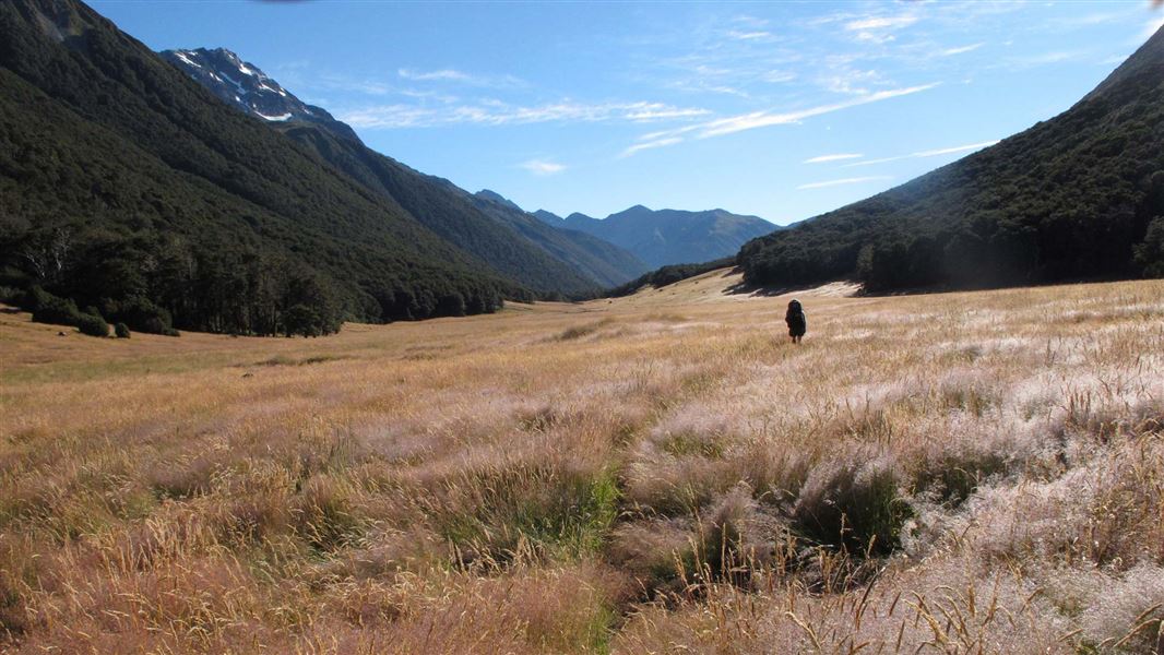
Ada Valley, St James Walkway.
St James Walkway

Located in Lewis Pass Scenic Reserve and St James Conservation Area in the Canterbury region

This track passes through pastoral land, beech forest and sub-alpine regions.

Walking options

The St James Walkway is commonly done over 5 days / 4 nights. It's suitable for both beginners and experienced trampers.

For family groups the descent into Cannibal Gorge provides an invigorating shorter walk along a well formed, boardwalked track.

Ensure you stay on the formed track on the section from Magdalen Hut to Boyle village as this crosses private property.

Places to stay

There are five Serviced huts on the walkway: Cannibal Gorge,  Ada Pass, Christopher,  Anne and Boyle Flat huts.

In addition trampers can also stay in Magdalen and Rokeby huts.

Note: During the summer it is recommended that you carry a tent as accommodation within the huts is limited and available on a first come basis.

This description covers the walk beginning at the Lewis Pass picnic area and ending at the Boyle shelter. The walking times are average for a reasonably fit and experienced adult tramper.

Note: True right and left banks of a river are determined when facing downstream.

Parts of the St James Walkway are complex avalanche terrain. All avalanche paths on the walkway are marked.

You should not stop in the marked places. Avalanches are most likely to happen during periods of heavy rain or snow, and for 24 hours after the end of a storm. Special care should be taken if crossing old avalanche debris. Do not stop to play in the snow.

Lewis Pass - Cannibal Gorge Hut - Ada Pass Hut

Time: 3 hr 30 min to Cannibal Gorge Hut, 5 hr to Ada Pass Hut
Distance: 7 km to Cannibal Gorge Hut, 10 km to Ada Pass Hut

The track leaves the picnic area on the Tarn Nature Walk across a natural open bog. It then enters the bush, descending in a steep zig-zag into Cannibal Gorge on the Maruia River.

A swing bridge crosses Cannibal Gorge to the true right bank. From here it is about 6 km to the Cannibal Gorge Hut. Past the hut the track follows an easy grade alongside the Maruia River, through beech forest and open alpine fields (prone to avalanches) to Ada Pass Hut (3 km - 30 minutes).

Ada Pass Hut - Christopher Hut

Time: 4 hr 30 min
Distance: 10.5 km

From the hut, the track leads through bush over Ada Pass into the Ada valley. Beech forest gradually gives way to open areas of tussock with tongues of mountain beech. 

Orange triangles at the clearing edge indicate the start of the track through bush areas, following the true right bank of the Ada River.

At the confluence of the Ada and Christopher rivers, the track passes the historic Christopher (Ada) Cullers Hut. The Christopher Hut is 10 - 15 minutes walk from this point, close to the edge of the bush, about 350 metres from the Ada River.

Christopher Hut - Anne Hut

Time: 4 hr, 30 min
Distance: 13 km

From Christopher Hut the route goes down the valley along the true right bank of the Ada River to where the open flats converge with the river and toe of the hill, about 1.5 km above the Ada homestead.

The track eventually joins a vehicle track for some distance to the Henry / Waiau valley confluence. From here it passes through matagouri thickets and some open rolling and swampy ground and rejoins the vehicle track (up till now the track is on the true left bank of the Henry River).

After crossing a suspension bridge over the Henry River the track follows close to the true right bank, rejoining the vehicle track through to the Anne Hut.

There is no longer a radio at Anne Hut. 

Anne Hut - Boyle Flat Hut

Time: 7 hr 30 min
Distance: 17 km

The track crosses a footbridge over the Anne River to gain access to the true left, and 2 km upriver it crosses another footbridge back to the true right. The track continues up and over the Anne Saddle into the Boyle Valley. Orange pole markers indicate the route over the Boyle Flats, past the basic Rokeby Hut. The true left bank is followed to a suspension bridge over the Boyle River, 100 metres from the Boyle Flat Hut.

Boyle Flat Hut - Boyle settlement

Time: 5 hr
Distance: 14.5 km

After re-crossing the footbridge to join the walkway route on the true left bank, follow markers to the start of the track through the gorge.

A suspension bridge crosses the Boyle River, then the track follows the true right bank to another suspension bridge.

Magdalen Hut is 30 minutes from this second bridge.

A vehicle track is joined and followed down the valley to the shelter and car park at SH7by the Boyle settlement.

Both ends of the track are on SH7 (Lewis Pass Rd) - one end is near the top of Lewis Pass, and the other end is at Boyle Village.

Car parking

Car parking is available at both entrances, but the Boyle area is more secure. The area is subject to vandalism.

There have been reports of cars being broken into and disabled especially the start of the St James carpark at the top of Lewis Pass.

  • Don't leave valuables in your vehicle.
  • Consider using more public parking sites – Boyle River Outdoor Education Centre offers secure parking and a drop off service. Book in advance.
  • Report any suspicious activity to the police.

If you have your own transport you should begin the walk from the top end of the Lewis Pass and finish at the car park near Boyle settlement.

What to expect

It is well signposted and marked, including stretches of open farm land where cairns and markers indicate the route.

The walkway is not difficult but the climate can be extreme. It should not be attempted during winter months unless you are an experienced tramper.

Be prepared

While the St James is not a difficult walk, its location in a sub-alpine area with erratic weather conditions necessitates safety precautions:

Travel with a group: Never travel alone. In the event of an accident, there is a better chance of prompt help. Four is a safe minimum.

Advise your intentions: Inform friends or relatives of your intended route and completion date for the walk. Also sign the record books in both the Boyle and Lewis Pass shelters and huts. If you are overdue, search and rescue action can be taken promptly and effectively.

Topo50 series maps: BT23 Lewis Pass, BT24 Ada Flat, BU23 Boyle Village

Clothing and footwear: Be prepared for the worst - bad weather is a possibility regardless of season. Carry warm clothing and include waterproof parka and over-trousers. Sturdy, comfortable boots are essential, as is a good pack and a sleeping bag with waterproof cover. On half day trips strong shoes and a parka are minimal equipment.

Note: All parties should be self-sufficient in case of an accident or huts being full.

First aid kit: Carry a small first aid kit.

Weather forecast: Check the Canterbury High Country weather before you start.

There may be avalanche danger

Find out about avalanche danger in St James Conservation Area

Avalanches in St James Conservation Area can occur in any season, but are more common from May to November.

If you are going into avalanche terrain:

  1. Have avalanche skills and training.
  2. Check the ATES rating and the St James Conservation Area weather forecast
  3. Take and know how to use an avalanche transceiver, a snow shovel and a probe.