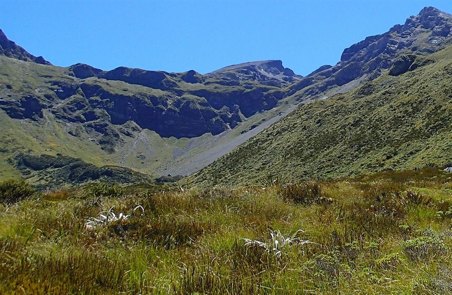
Ellis Basin.
Ellis Basin Route

Located in Kahurangi National Park and Mount Arthur area in the Nelson/Tasman region

Enjoy extensive views of the Ellis Basin and the surrounding mountains on this track to Ellis Hut.

The access road into the Mount Arthur area (Graham Valley Road) is steep and narrow and prone to corrugations and slips – check any alerts for road status. During the winter months a 4WD vehicle is recommended to access Flora carpark. Chains may be needed if snow and ice are present

Flora car park - Mt Arthur Hut

Time: 1 hr 30 min
Distance: 4.2 km

Mt Arthur Hut - Mt Arthur summit

Time: 2 - 3 hr
Distance: 5 km 

Mt Arthur ridge - Ellis Hut

Time: 1 - 2 hr
Distance: 2.5 km

The poled route to Ellis Hut is signposted from the Mt Arthur ridge near Winter Peak, on route to Mt Arthur summit.

The route follows the ridge off Winter Peak, then down the side of Ellis Basin. You'll be walking over rocky scree for part of the descent and on steep, slippery terrain, so take your time and watch your footing. Sturdy boots with good ankle support are essential here.

As you reach the bottom of the basin, you cross a side stream (unbridged) then head down to Ellis Hut, situated at the bush line.

Ellis Hut - Baton Valley Road

Time: 5 hr 30 min
Distance: 10.3 km

From Ellis Hut an arduous tramping track continues down the Ellis valley to the Baton Valley Road end. The track follows the Ellis River, crossing the river many times (all crossings unbridged). Assess the river carefully before crossing – if river levels are high, it will not be safe to cross.

The valley is steep-sided and there are lots of ups and downs on the track, including climbing and scrambling over rocks and tree roots. This is a rough backcountry track, and you can expect to encounter fallen trees and damage on the track. It’s best to plan extra time into your day, in case this section of the track takes longer than you expect.

Flora car park is 75 km from Nelson and 36 km from Motueka.

The Motueka Valley Highway links Nelson and Motueka. Turn off this road at Ngātīmoti and cross the Motueka River. Turn left onto Motueka River West Bank Road, then right into Graham Valley Road, which climbs steeply to the car park. The last 5.8 km is unsealed and turning a vehicle on the road can be difficult. 4WD is recommended at all times of the year.

Pack for extreme weather

This trip is exposed and trampers need to be prepared for adverse weather conditions. High wind, low visibility, heavy rain and freezing temperatures can occur at any time of year. Check the weather forecast before you go and always pack plenty of warm and waterproof clothing.

This is a remote spot – carry a distress beacon and emergency shelter

There is no cell phone reception and low numbers of trampers, so always carry a distress beacon. Pack an emergency shelter in case you are trapped by weather or high rivers.

Stay safe when crossing rivers

If you plan to cross unbridged rivers, know how to cross safely and be prepared for if you cannot cross.

Do not cross if the river is flooded, you cannot find safe entry and exit points or are unsure it’s safe. Turn back or wait for the river to drop. If in doubt, stay out.

How to cross rivers safely

Be careful if going off track

Ellis Basin is famous for its spectacular kaarst landscapes and deep cave systems. Take care if you are heading off track, as tomos and cave entrances are not marked.