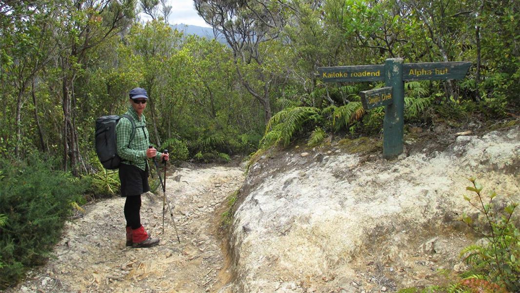
13 km (return to Smith Creek Shelter). 11.5 km (Dobson loop)
Kaitoke Road End to Smith Creek Shelter via Puffer Saddle – returning back on the same track (13 km, 4 - 5.5 hours; walking track)
The track begins on Kiwi Ranch Road. It climbs steadily towards Puffer Saddle, passing a turnoff to the Southern Crossing on the way. From the saddle, the track descends into Smith Creek valley, then follows the creek down through red/hard beech forest, to the confluence of Smith Creek with the Tauherenikau River.
There is a large, old slip on the track in the Smith Creek section. The return trip to Smith Creek Shelter was previously around 4 hours, but traversing this slip may add up to 1.5 hours extra to the walking time. Follow the marked alternative route.
From Smith Creek Shelter, you can also walk further up the Tauherenikau Valley to Marchant Creek for views of the river and the young podocarp forest regenerating in the manuka on the flats.
Return back to the road end the way you came, following the track up Smith Creek and over Puffer Saddle.
Be aware that the track includes sections of clay and can be extremely slippery. Wear footwear with good grip.
There are also several unbridged stream crossings, on the section of track that follows Smith Creek. These may not be safe to cross during/after heavy rain.
Dobson Loop Track – full loop tramp (11.5 km; tramping track)
The full Dobson Loop Track is more challenging than the track described above. Around half of the loop is a rough tramping track and there is a long steep ascent/descent on the track which is physically demanding. It is best suited to fit walkers with experience in backcountry tramping.
The track begins on Kiwi Ranch Road. It climbs steadily towards Puffer Saddle, then reaches a turnoff with the Southern Crossing track. For a clockwise loop (described here), take this track.
The track climbs steadily for some time, until you reach a turnoff near the old Dobson Hut site (there is only some concrete left now). Take the turnoff, signposted towards Smith Creek shelter. The track descends steeply all the way down to the Tauherenikau River. It is a rough track with many tree roots, go slowly and carefully as it is easy to slip.
The track emerges near Smith Creek Shelter, near the confluence of Smith Creek with the Tauherenikau River.
From here, follow the track that leads up the Smith Creek valley. There is a large, old slip on the track in this section, which can take up to 1.5 hours to traverse. Follow the marked alternative route. There are also several unbridged stream crossings in this part of the track, which may not be safe to cross during/after heavy rain.
The track climbs out of Smith Creek valley to Puffer Saddle, then descends towards Kaitoke. It meets the turnoff with the Southern Crossing, then the track continues down to Kiwi Ranch Road.
Turn off State Highway 2 onto Marchant Road at the YMCA Camp Kaitoke turnoff. Near the end of Marchant Road, turn right into Kiwi Ranch Road. The carpark is located on the left, approximately 500 m along Kiwi Ranch Road.
Expect a challenging day walk
The track from Puffer Saddle to Smith Creek Shelter has sections of clay that are extremely slippery after rain, as well as tree roots on the track. There is also a large slip which needs to be traversed.
The full loop is more challenging than the track to Smith Creek Shelter via Puffer Saddle. You can expect a long, steep section, a muddy and very slippery track when it has been wet, an unformed tramping track, and many tree roots.
The full loop is best suited to fit, experienced trampers.
Leave early and plan extra time in your day in case it takes longer than you expect.
Be prepared for bad weather
Bad weather (including rain and cold) is common in the Tararua Forest Park. Check the forecast before you go.
Always pack warm and waterproof clothes, as well as plenty of food and a head torch. Find a day hike packing list.
Consider carrying a distress beacon, in case of emergencies. You will not be able to rely on internet-based maps for navigation, so pack a map and compass (or other off-line navigational aid).
Stay safe when crossing rivers
If you plan to cross unbridged rivers, know how to cross safely and be prepared for if you cannot cross.
Do not cross if the river is flooded, you cannot find safe entry and exit points or are unsure it’s safe. Turn back or wait for the river to drop. If in doubt, stay out.
Stay safe in the outdoors
- Choose the right trip for you. Learn about the route and make sure you have the skills for it.
- Understand the weather. Check weather forecasts.
- Pack warm clothes and extra food. Check gear lists.
- Share your plans and take ways to get help. Share directly or use the Outdoor Intentions form or Plan My Walk. Take a distress beacon.
- Take care of yourself and each other.
Wellington/Kapiti information | |
Phone: | +64 3 546 9339 |
Email: | nelsonvc@doc.govt.nz |
About: | Whakatū/Nelson Visitor Centre provides visitor information for this area |