Upper track 4.2 km, Lower track 6.2 km one way
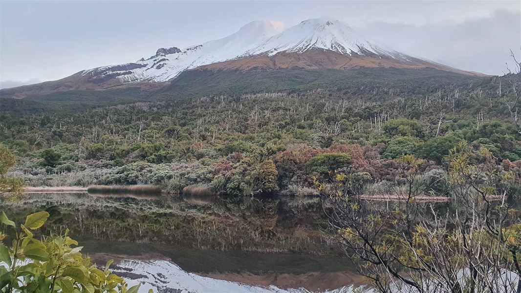
The picturesque Lake Dive lies at the foot of the upper Beehive, a cumulo dome created when lava welled up and congealed before it could burst through.
There are two options to get to Lake Dive (proposed to be renamed Mangoraukawa) - the upper and lower Lake Dive tracks. You can combine the tracks to make a 13 km loop track.
Upper Lake Dive Track
Distance 4.2 km
Time: 3-4 hr
From the road end at Dawson Falls the upper Lake Dive Track follows Fanthams Peak Track through forest to the junction with the Lower Lake Dive Track.
Here the track turns right and steadily climbs up steps, past the Hilary Seat, Hooker Shelter, and Kapuni Lodge Track to approximately 1500 m altitude. At the junction, the Lake Dive Track heads left to follow marker poles across exposed alpine tussock slopes before descending steeply down to the lake.
The upper section of this track is exposed to the weather and requires ice axe and crampons in winter conditions.
Lower Lake Dive Track
Distance: 6.2 km
Time: 3-4 hr
From Dawson Falls Road end, the Lower Lake Dive Track follows Fanthams Peak Track then branches left at the junction, passing Hastie’s Hill, undulating through forest and crossing many unbridged streams before arriving at the lake.
This track is more protected from the weather than the Upper Lake Dive Track, but it has unbridged stream crossings that can make it impassable in bad weather.
There used to be a Lake Dive Hut, but it burnt down in 2020.
Start this track from the Dawson Falls road end.
- Starting in Stratford, turn off SH23 into Celia Street, which becomes Opunake Road.
- Follow this for 14 km, then turn right into Manaia Road.
- Continue on this road for 9 km up the mountain to Dawson Falls Visitor Centre.
Be prepared for changeable weather
Weather on the mountain changes rapidly – you must be well prepared with suitable clothing and equipment for all weather and conditions.
Snow, high rainfall and storm damage can make tracks impassable – many rivers and streams are unbridged.
Check the Egmont National Park weather forecast before you go.
Expect challenging track conditions
The upper track is very exposed and not recommended in winter unless parties are equipped with ice axe and crampons. It is better to return on the lower track during this time of year.
Expect overgrown sections of track and some erosion in places.
Stay safe when crossing rivers
If you plan to cross unbridged rivers, know how to cross safely and be prepared for if you cannot cross.
Do not cross if the river is flooded, you cannot find safe entry and exit points or are unsure it’s safe. Turn back or wait for the river to drop. If in doubt, stay out.
Stay safe in the outdoors
- Choose the right trip for you. Learn about the route and make sure you have the skills for it.
- Understand the weather. Check weather forecasts.
- Pack warm clothes and extra food. Check gear lists.
- Share your plans and take ways to get help. Share directly or use the Outdoor Intentions form or Plan My Walk. Take a distress beacon.
- Take care of yourself and each other.
Taranaki/Egmont National Park Visitor Centre
| Phone: | +64 6 756 0990 |
| Email: | egmontvc@doc.govt.nz |
| Address: | 2879 Egmont Road Egmont National Park 4386 |
| Hours: | Visitor centre hours and services |
