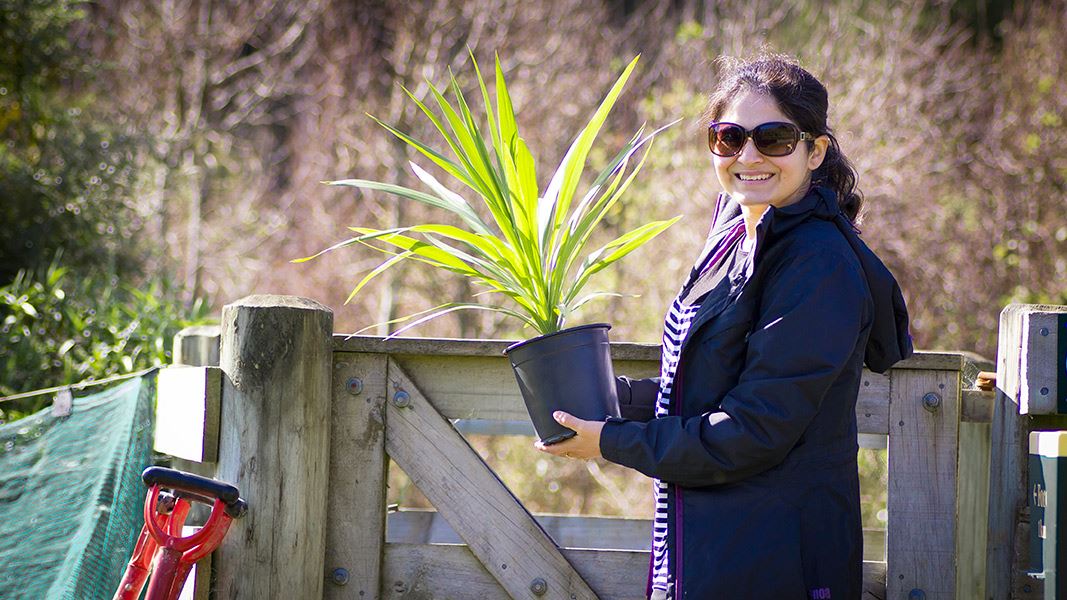
Ecological restoration is the process of reestablishing a self-sustaining habitat or ecosystem similar to what is likely to have existed before human contact. The restoration could involve the reintroduction of native fauna and flora, and the eradication or control of pests.
When reintroducing plant species, the aim should be:
In the highly modified Waikato landscape where native plant populations are diminished and fragmented, it may not be possible to recreate exactly what was once there. Some species may not be readily available or difficult to propagate.
However we should do everything possible to try and keep the natural character of the local vegetation. Therefore ecosourcing is a crucial element of local restoration, and is supported by the New Zealand Biodiversity Strategy.
Ecosourced Waikato (a group representing plant growers, the Department of Conservation and local and regional authorities) has developed native plant lists for different habitat types in the Waikato District. Funding support was provided by the Waikato District Council as well as the Department of Conservation with considerable input from Wayne Bennett of Forest Flora.
The lists are designed to assist ecological restoration in the Waikato They are not intended to be a comprehensive description of the primeval forests/wetlands/vegetation of habitats. They should be viewed as a simplified recipe for the reconstruction of natural patterns and processes, based on the experience of plant growers involved in ecological restoration.
Ecological restoration is not usually a one-off activity. It may require a number of interventions in order to restore natural patterns and processes. Restoring less common species may require specialist advice.
Any suggestions for corrections or improvements to these lists should be emailed to waikato@doc.govt.nz.
The Waikato River has developed an entrenched course as it flows through the Hamilton Basin on its way north. At Ngaruawahia it is joined by its main tributary, the Waipa River, before continuing north to Mercer and then turning west to reach the sea at Port Waikato
Along the stretch of river from just south of Hamilton out to the sea, a number of landforms have evolved, from ignimbrite cliffs, steep pumice banks, river terraces, back swamps, islands, tidal waters and saltmarsh. This variation in landform means a variation in the composition of the vegetation. For this reason, the planting lists cover different sections of the river and within each section there are a number of different zones.
Planting guide for Waikato River mouth to Tuakau Bridge (PDF, 577K)
The section of river from Port Waikato to the Tuakau Bridge includes four distinctive zones:
Planting guide for Lower Waikato River - Tuakau Bridge to Ngaruawahia (PDF, 484K)
This section of the river is prone to flooding, with winter flood levels likely to be several metres above summer levels every year, often for long periods at a time. This regime eliminates flood intolerant species from a large area of riverbank and shortens the growing season. The zones are:
Planting guide for Lower Waikato River – Ngaruawahia to Tamahere (PDF, 604K)
This section of the river from Ngaruawahia to just south of Hamilton city has a mix of landforms from steep ignimbrite cliffs to sandy/pumice river terraces with numerous springs and seeps. Three zones are recognised:
The Waipa River enters the Waikato River at Ngaruawahia, cutting through deep pumice soils deposited when the Waikato River flowed over the same landscape many years before.
Planting guide for Waipa River – Whatawhata to Ngaruawahia (PDF, 502K)
The planting guide covers these zones:
The peat lakes of the Hamilton Basin formed where sand and gravel from the Waikato River blocked valleys. Subsequently, thick peat has developed around them.
Planting guide for Hamilton Basin – Horsham Downs Peat Lakes (PDF, 336K)
Peat lake margins have low fertility waterlogged soils supporting a low stature plant community. Further back from the lake edge, the mineralised zone at the foot of low hills supports a tall, many layered forest dominated by kahikatea.
Planting guide for Hamilton Basin – Lake Rotokauri (PDF, 466K)
Lake Rotokauri is situated on the edge of Hamilton city and although there are increasing amounts of urban development in the area, there is still some natural vegetation with potential for restoration. The lake margins would have originally been of low fertility but changing land use in the surrounding catchment has tended to raise nutrient levels. This now presents challenges in terms of reestablishing low fertility plant.
Planting guide for Hamilton Basin - Kahikatea remnants (PDF, 364K)
The rich alluvial floodplains of the Hamilton Basin have largely been cleared of forest for farming but there are still some small remnant stands dominated by kahikata scattered across it. Many remnants are located in areas that have been extensively drained so the choice of plants for restoration purposes needs to be based on whether the ground is now predominantly wet or dry.
A number of riverine lakes are found north of Huntly between the western coastal hills and the Taupiri and Hapuakohe Ranges. The margins of these lakes are swampy, being fed by river water rather than the peat forming margins normally associated with lakes in the Hamilton Basin.
Planting guide for Meremere Basin (PDF, 461K)
That part of the Waikato District situated between the Waikato River and the Tasman Sea is largely rolling hill country, bounded by the Hakarimata Range in the south east and the coastal settlement of Raglan and the Karioi coastline in the south west, up to Port Waikato in the north. Inter-dispersed amongst these hills are areas of low-lying land and alluvial valley floors, sometime seasonally flooded and in places, swampy. Lakes Whangape, Rotongaro and Waahi and associated wetlands are found in this area.
Planting guide for Western ranges, hills and valleys (PDF, 1,138K)
This planting guide covers seven distinct zones:
Planting guide for Raglan Coast (PDF, 630K)
This planting guide covers five zones:
A series of ranges and rolling hill country dissected by broad alluvial valleys lies east of the Waikato River from Taupiri north to Mangatangi. Sandwiched in between are Lakes Waikare, Ohinewai, Kimihia and Hakanoa and their associated wetlands.
Planting guide for Eastern Waikato (PDF, 897K)
The planting guide covers three distinct landscape features:
For further advice or information about ecosourcing or native restoration projects in Waikato, contact:
DOC Customer Service Centre
Phone: | 0800 275 362 |
Email: | hamilton@doc.govt.nz |
Address: | Kirikiriroa / Hamilton Office |
Wayne Bennett
Ecosourcing Coordinator
Phone: +64 21 274 2132
Visit the Forest Flora website