8.7 km return via same track

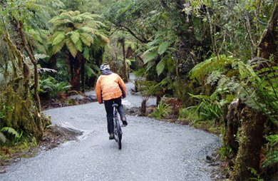
Cyclist on Te Ara a Waiau Walkway/Cycleway
Pick up the track on the right hand side of the road outside the Westland Tai Poutini National Park Visitor Centre, before crossing and then going under the Waiho River bridge.
The track then runs along the left hand edge of the Glacier Access Road for approximately 1.7 km on a sealed lane marked for walkers and cyclists. Keep off the road lanes.
Approaching the Rata Grove, a gravel track heads into the forest on the left hand side of the road for a short time, before re-emerging from the forest and crossing the Glacier Valley Access Road. Take care to give way to all traffic and cross carefully.
Once across the road the track winds its way easily up the valley through lush rainforest with abundant birdlife. The track crosses the Lake Wombat Walk just minutes from the road crossing – take care at this intersection also, cyclists watch for walkers crossing! Views of the mountains and upper valley are possible at times as you head up the valley.
Cyclists must leave their bikes at the bike rack at the end of Te Ara a Waiau – there is no bike access on any other tracks in the area.
Mountain biking
This is a shared-use track. Follow the mountain bikers code: respect others, respect the rules, respect the track.
Te Ara a Waiau starts from SH6 just outside the Westland Tai Poutini National Park Visitor Centre.
- Check the current track conditions and weather forecasts at the Westland Tai Poutini National Park Visitor Centre before starting your trip.
- Always take warm and waterproof clothing as the weather can change rapidly.
- Carry drinking water, insect repellent and sun protection at all times.
| Westland Tai Poutini National Park Visitor Centre | |
|---|---|
| Phone | +64 3 752 0360 |
| westlandnpvc@doc.govt.nz | |
| Address | 69 Cron Street Franz Josef Glacier 7856 |
| Hours | Visitor centre hours and services |
